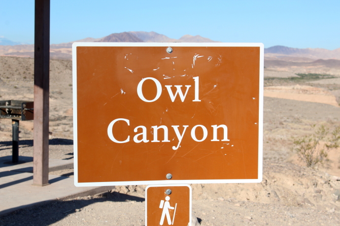
The last time I hiked in Owl Canyon, it was an out-and-back trail. Therefore, I was surprised to learn that on AllTrails it now makes a loop by connecting Owl Canyon to other trails that lead back to the trailhead.
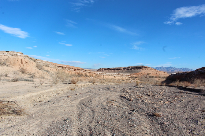
The Owl Canyon trailhead is located on a hill overlooking a mostly dry arm of Lake mead. (There is some water that still flows down Las Vegas Wash.) From the top of the hill Owl Canyon is visible to the northwest, behind a hill that points eastward. We ended up returning down the drainage on the south side of the hill.
From the trailhead, Owl Canyon Trail drops to an area that is now dry, but was once covered by water when Lake Mead was full. It is easy to follow the trail across the dry lake area because some ambitious group has lined the trial with rock borders. Along the way there are several areas that contain shells deposited when the lake was full.
 |
| View northwest - Owl Canyon to the right of the pointed hill. |
 |
| View north from trailhead. |
 |
| View east from trailhead. |
 |
| Trail with rock borders. |
 |
| Dry arm of Lake Mead. |
 |
| Trail goes up a small hill. |
 |
| Trail follows historic Lake Mead shoreline. |
 |
| Shells deposited along historic Lake Mead shoreline. |
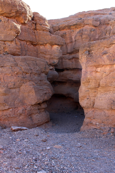
The mouth of Owl Canyon is fairly wide, but narrows fairly quickly when moving into the canyon. Since the canyon is located on an alluvial slope that was created by the deposition of sediment over a long period of time, the canyon is not very colorful. In places sunlight gives the canyon a red glow, but the soil is really a gray color that does not photograph well. Plus, we were there early in the morning during the fall when the sun was at a low angle.
Owl Canyon gets its name because during certain times of the year this is a nesting area for white owls. There were no owls nesting during our hike, but owl nests could be seen on the canyon walls.
We exited the canyon through a slot that was a short distance from a large metal culvert running under Lakeshore Road. After passing through the culvert, the trail continues and then runs through a set of metal culverts running under the River Mountain 34-Mile Loop Trail (34-Mile Loop).
Once on the other side of the two culverts, the trail makes a sharp turn to the right and then goes up a small hill and connects to the 34-Mile Loop. This is part of the Owl Canyon Loop Trail that goes back to the trailhead.
We elected to take a different route. After walking through an area of red soil, we climbed out of the canyon by following a drainage from the ridgeline on the south side of the canyon. There was only a faint trail to follow (if it was even a trail), so we just made our way up the hill following an eroded fault.
 |
| Trail connecting Own Canyon to River Mountain 34-Mile Loop Trail. |
 |
| Area of red soil. |
 |
| Looking back while climbing out of Owl Canyon. |
 |
| Near the ridgeline. |
Once on top of the ridgeline, we found an old road that went toward the Owl Canyon trailhead. The old road ended at the 34-Mile Loop, so crossed over the trail and continued down the drainage. There was one small drop that required some climbing before we reached a culvert that ran under Lakeshore Road; but after exiting the culvert, it was an easy hike back to the Owl Canyon Trailhead.
 |
| Looking up Owl Canyon from the ridgeline. |
 |
| Old road on top of ridgeline. |
 |
| River Mountain 34-Mile Loop Trail. |


No comments:
Post a Comment