Friday, November 29, 2019

RonnieAdventure #0388 - Payson City, Utah


On October 20, 1850 Mormon pioneers first settled in what is now known as Payson (Utah) and by 1851 there were sixteen families living in the area. They built a small fort around their settlement and called the town "Peteetneet," after the local Ute Indian leader. Brigham Young later changed the name of the town to "Payson," in honor of James Paces, the settlement's founder. 

Logs for the first fort were cut from the nearby creek and lashed together so tightly that even a small animal could not penetrate the walls. According to the Payson Historical Society: "In 1853 Indian uprisings made it necessary to enlarge the fort to accommodate the families that had moved into the new settlement. The fort had a four-foot deep moat at the bottom, a base of rocks and an eight-foot wall of adobe with bastions on the corners. It was about four city blocks square. The main gate was on the east side."

The Payson Historical Society gave me a small booklet that contained a walking tour of the original town site and a map that showed the locations of various historical markers. The booklet also contained a description of each marker and what happened at the site.

I decided to follow the historic walking tour, which started at the fort's southeast corner. There are two foundations at the corner because on May 20, 1973, the original marker was washed away when an upstream reservoir broke and sent a nine-foot wall of water down the canyon and into the town of Payson. The original marker was later recovered, so now there are two foundations in slightly different locations.

A plaque at the corner marker states "The fort was 60 rods square with corners built of logs forming a buttress.. Adobe, rocks, and mud walls stood 8 feet tall, 4' wide at the bottom and 2' at the top. On a rock foundation with a deep 4' trench around the outside. It was built during the Walker Indian War 1853-1854." The Main Gate marker is just a few yards north of the fort's southeast corner and the plaque states: "Just inside was a stagecoach inn and Pony Express Station which operated until the telegraph came in 1861." Almost the entire historic area is now covered with modern houses.

Southeast Corner of fort and location of main gate
The fort's other three corners have similar markers and along the walking tour there are descriptions of the various historic structures.

Northeast Corner of fort
Northwest Corner of fort
Southwest Corner of fort
Cow Lane - Path used to move cattle to pastures
Although not in the downtown historic area, the old Peteetneet School is located on a hill to the east of the old fort site. The school was built in 1901 and named for the Ute Indian Chief Peteetneet for his help provided to the early pioneers. After the school was abandoned, it was restored by preservation efforts of the local residents and the building is now used for a Museum and Cultural Arts and Social Center.

 A statue of Peteetneer, the Ute Indian Leader, stands in front of the west side of the building, but most people enter the building from the east side, which is also very picturesque. Entrance to the museum is from a new addition located to the north of the school building. 


East entrance to building
The day I visited the museum they were having a quilt show, which filled most of the rooms.


An early log cabins that was built in 1863 by Everett Richmond has been preserved and relocated to the Payson City Center. 

The population of Payson in the 2010 Census is listed as 18,294.


The current Payson City Library was build in 1925 as a JC Penny Store and then converted to a garage, an antique store, and in 2000 purchased by the City for a municipal library. 


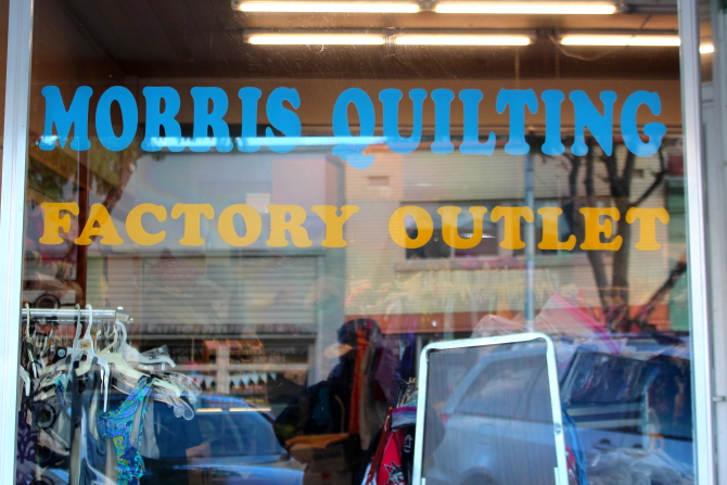
The downtown historical area is filled with small shops, including a quilt shop.


Payson City's Memorial Park contains numerous historical monuments, in addition to some nice picnic facilities,


A pioneer millstone in the Park marks the approximate location of the first public building -- a log cabin that served as a church and school. 

In 1853 a saw mill and flour mill were constructed in the area and in 1860 one of the first nail factories west of the Mississippi River was built. A plaining mill, one of the first in Utah Territory, was constructed in 1861 and Payson's first public school was opened in 1866.


A plaque near the original school bell states that the first two-story brick building in Payson was located 377 feet west and 14 feet south of this marker. The building was used for City offices, the first high school, and a recreation center. The City Marshal rang the bell in the morning signaling the start of school and then again at 8 PM signaling a curfew for children under 12 years of age. 


There is also a memorial that was built in memory of Alexander Keele who was killed on July 18, 1853, while on guard duty during the Walker War.  


Also located in the park is a marker commemorating the the Dominguez y Escalante Expedition of 1776. 

On July 29, 1776 Fathers Francisco Atanasio Dominquez and Silvestre Velez de Escalante left Santa Fe to discover a northern overland route to Monterrey, California. In early September the party passed through Spanish Fork Canyon and entered the Utah Valley, where they stopped to preach Christianity to the Indians that inhabited the area. However, by October the party was discouraged by the cold weather and, running short of supplies, they decided to return to Santa Fe. After a 2,000 mile journey, the expedition arrived back at Santa Fe on January 2, 1777.


There were many beautiful trees with fall colors along the roads around Payson.


BONUS PICTURE (horse with his dress hat on)


Friday, November 22, 2019

RonnieAdventure #0387 - Heber City/Midway, Utah


Most of the people that work in Park City can not afford to live there; so many workers commute from the communities of Heber (population 11,362) and Midway (population 4,923), which are located about 13 miles to the south in what is known as Heber Valley.

The Heber Valley Artisan Cheese  and Kohler Creamery is located on the outskirts of Midway and the first stop if traveling south from Park City. Their web site states: "At Heber Valley Artisan Cheese our mission is to help others experience the difference of the farmer's touch. Our fully integrated dairy farm to creamery delivers a true farm-to-table experience. In fact, we believe the finest handcrafted cheeses, fresh or aged, begins with the perfect base premium milk  pure, rich and creamy, a 'recipe' we've been perfecting on our farm for nearly 100 years." There are a lot of different types of cheese that you can sample and purchase in the showroom; but the ice cream line was way too long, so I just sampled the different types of cheese.


The Midway Geothermal Area has been recognized as an "interesting and unusual geologic feature" since it was discovered by early pioneers. Homestead Crater is a distinguishing landmark in the geothermal area because it is 55 feet tall and about 400 feet in diameter at its base. The dome is believed to be about 10,000 years old and is made of "trifa" or "travertine" that was formed by overflows of mineral rich water.

It has been theorized that water percolated into the ground and followed cracks in the earth to a depth of one-to-two miles. The heated water then returned to the surface and deposited the material known as "travertine" to form the crater cone. Water currently flows through cracks in the crater at a rate of about 135,000 gallon per day.

Water level in the crater is now stabilized at about 45 feet from the crater rim. The crater opening at the top has been screened to keep people and objects from falling into the crater from above, but there is a bridge over the crater hole so that visitors can look down into the crater. Steps to the top of the crater are steep and numerous. Water in the crater is 65 feet deep and there is about a 14-foot deep layer of silt on the crater floor. Excavations in the crater have discovered "thousands of coins, guns and other interesting artifacts."

In 1996 a 110 foot-long tunnel was excavated into the side of the crater cone to provide access to the water. The crater water is now a popular destination with scuba divers, snorkelers, and swimmers.


Photographer Unknown

Since the 1800s local residents and miners have visited the area to soak in the 96 degree hot springs mineral water, seeking relief from their aches and pains. To accommodate out-of-town guest and world travelers, the Homestead Resort was built on the site and offers indoor and outdoor swimming pools, spa, scuba lessons, tennis courts, golf course, horseback ridding, hiking trails, and a host of other outdoor activities. And, of course, in the winter the resort is only 13 miles from Park City, which has the largest ski area in the Unites States.


There is a nice monument in the Midway City Park, but I am not sure what it represents.


Located on Main Street is an abandoned gas station with some interesting exhibits. 


I was informed that the facilities at Johnson Mill are currently being used as an addiction treatment center; so I just walked around the grounds, but did not go inside.


On the drive from Midway to Heber, Utah State Highway 113 passes by the Legacy Covered Bridge (GPS Coordinates: 40 30.440, -111 27.003) that spans the Provo River. The 120-feet long bridge is only open to pedestrians and cyclist.


Heber is best known as the home of Heber Valley Railroad. Over 110,000 people each year visit Heber to ride the scenic excursion train between Heber and Vivian Park, which is located in beautiful Provo Canyon. The Heber Valley Railroad was previously known as the "Heber Creeper" because the steam locomotive's maximum speed was 20 miles per hour.

As of 2018, the two 1907 Baldwin 2-8-0 Consolidation-type steam locomotives were both in the locomotive shop for their 1,472 day inspection and service. One of the steam engines is being converted from coal to oil burners and is projected to be back in service in 2020. However, in the interim, the railroad has four diesel-electric locomotives that can be used to pull passenger cars,


Located at Russ McDonald Field in Heber is the Commemorative (CAF) Utah Wing Museum. The museum is dedicated to "Honoring American Military Aviation through Flight, Exhibit and Remembrance" and contains historical items from WW II, Korean War, and Vietnam War. 

When I stopped by the museum, it was closed; so I had to just take a few pictures through the fence. Also located at the airport was a car mounted on the side of a building that looked like Doc Hudson from the movie Cars. 


Bridal Veil Falls received its name from an Indian Legend that tells of a young Indian maiden and an Indian Brave from a rival tribe that fell in love. Fearing her lover had been killed, the maiden leaped from the high ledges. According to the Legend, Mother Nature was touched by her death and made her a Bridal Veil of falling water. 


BONUS PICTURE