 |
| Web Picture - Unknown Photographer |
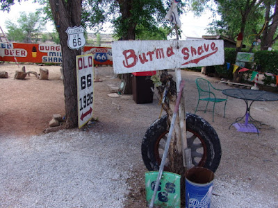
Several years ago some relatives from Denmark were touring the United States and wanted to visit the Grand Canyon. Since we had not seen the relatives in several years, we made arrangements to meet them and some other family members from the Phoenix/Tucson area in Flagstaff. On our drive to Flagstaff we needed a rest break so we stopped by historic Seligman. The town is a popular tourist destination because it is located about a mile off of Interstate 40 along Old Route 66.
In the late 1800s Seligman was a major stop on the Santa Fe Railroad mainline as it ran across northern Arizona. Seligman was also the terminal point for changing train crews between Winslow (Nevada) and Needles (California). Because there was a large flat, open area surrounding Seligman, just outside of town the railroad constructed a large switching yard that contained numerous sets of tracks and service facilities for steam engines.
Then, in 1905, Fred Harvey opened the Havasu Harvey House to provide food and lodging services for train passengers and local residents. For years Harvey House was considered to be the premier dining and lodging facility in the area.
Then, after WW II, many people wanted the freedom to travel around southwest United States by car and few people wanted to explore the west by train. Therefore, due to a lack of passenger business, the Harvey House closed in 1953 and was used for other purposes until it was demolished in 2008.
In 2005, the Seligman Main Street was placed on the National Register of Historic Places and over the past few years (excluding 2020) the town has seen a revival of interest as people are once again traveling across the country by private vehicles on Old Route 66. Many of the older buildings are now being renovated and more tourist-relate businesses are opening in Seligman.
Sunset Carter Volcano National Monument is just a short distance from Flagstaff. Tree ring dates and other geologic evidence places the last eruption of the volcano at AD 1065-1085. In many places the Park Service has placed boardwalks over the volcanic ash so it is easier to walk around the area and view the various sites. There are also informational markers along the way to explain the geological events that occurred there.
Humphreys Peak is the tallest point in Arizona (12,637 feet) and is just a short distance away from Sunset Crater. One time when I was in better shape I climbed to the top of Agassiz Peak (12,360 feet - the second highest peak in Arizona) and had planned to transverse over to Humphreys Peak, but a lightning storm drove me off of the mountain before I could complete the transverse. I have now crossed "Climb Humphreys Peak" off of my bucket list.
BONUS PICTURES
 |
| Historic Photograph from Web - Unknown Photographer |
In 1880 the transcontinental railroad was being built across northern Arizona, but work on the railroad came to a quick stop at Diablo Canyon. When the bridge arrived that had been ordered to span the canyon, it was discovered that the bridge was too short. Therefore, while waiting on a new bridge to be built and shipped, the town of Canyon Diablo sprang up at the edge of the canyon. Canyon Diablo quickly became the most dangerous place in the territory because there were no lawmen in town. Main Street became known as "Hell Street," consisting of 14 saloons, 10 gambling houses, 4 brothels, and 2 dance halls. The town had about 2,000 residents and operated 24/7 to keep the residents happy.
When the town's first lawman was hired and sworn in at 3:00 PM, he was buried at 8:00 PM the same night. Five more lawmen were hired - the longest one lasted about a month. A "Boot Hill" cemetery was started and soon had 35 graves, all of whom died from a violent death. The 36th grave was the trading post owner Herman Wolfe, the only one buried that died of natural causes. Wolfe's grave is the only one marked with a headstone that is still standing.
After the railroad bridge was completed, work on the line progressed quickly and the A&P Line linked up with the Southern Pacific Railroad at Needles on August 9, 1883. Once the bridge was completed, the residents left Diablo Canyon and it soon became a ghost town. Some of the ruins are still standing today.
 |
| Grave of Herman Wolfe |


