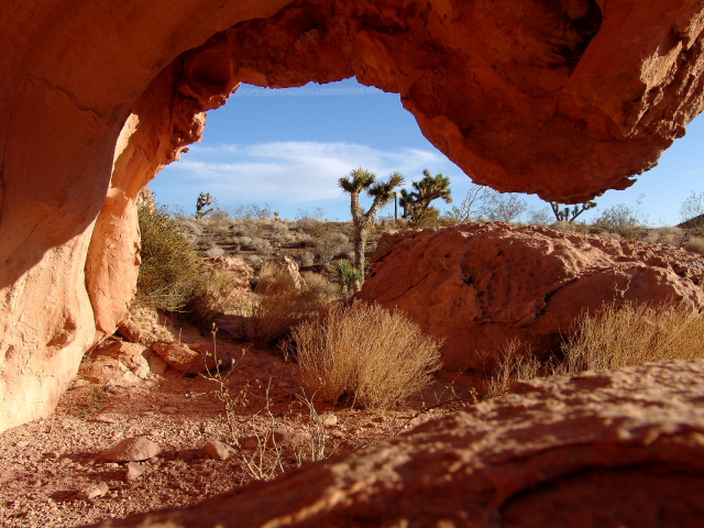
Gold Butte is Nevada's newest National Monument and covers about 300,000 acres of remote mountains and desert lands that contain a variety of sandstone sculptures and rock art. The Monument is located on the eastern side of Nevada, north of the Colorado River and adjacent to the Arizona boarder. Virgin Peak (shown above) is near the northeast corner of the Monument.
Before becoming a National Monument, most people outside of Nevada only knew of Gold Butte from television as the scene of the 2014 armed standoff dispute between rancher Calvin Bundy and the Bureau of Land Management (BLM).
In the 1800s the Bundy family homesteaded land in the Gold Butte area and over the years their cattle migrated over a much larger area then they owned. When the BLM wanted to collect fees from the Bundys for grazing cattle on public lands, and the Bundys refused to pay the fees (for 20 years), BLM decided to round up the Bundy cattle and place the cattle in holding pens. Obviously, things did not work out too well and several cattle died before BLM even got a good start on the roundup. The BLM, fearing trouble from the Bundy family, then brought in a number of armed forces; so the Bundy Family and a number of friends and volunteers also armed themselves. Fortunately, BLM released the captured cattle and everyone decided to call it a stalemate before anyone was killed. Who knows what will happen in the future.
I have not been to the Gold Butte area since it was designated a National Monument on December 28, 2016; however, over the years I have visited the area on several occasions.
New Gold Butte Road is paved from Interstate-15 to Whitney Pocket, but then the pavement ends and the road is graded dirt to the old Gold Butte townsite. After the townsite, the road is unmaintained, as are all of the other roads in the monument. I would highly recommend a high-clearance 4-wheel drive vehicle equipped with a full tank of gas and two spare tires for traveling on the unmaintained roads.
Gold was first discovered in the Gold Butte area in the 1880s, but active mining did not occur until about 1905. The town of Gold Butte was founded in 1908; but then after extracting a total gold production of only $75,000, the mines closed in 1910 and Gold Butte became a ghost town. All that remains at the site are some old foundations, two graves, and several mine shafts.
Most people that want to make a loop by traveling the un-maintained roads typically start at Whitney Pocket and travel in a counterclockwise direction, eventually ending up at the old Gold Butte townsite and then returning to Whitney pocket on New Gold Butte Road.
The first stop is Devil's Throat, which is a large sinkhole that is about 100 feet in diameter and 125 feet deep. I was told that the sinkhole is fairly recent (within the last one hundred years) and that two people in the area actually saw the plume of dust go up when the ground caved in.
There is an old cattle pen and chute several miles to the west that makes a nice photo stop.
Some of the most popular rock art panels are located adjacent to the road on the way to Kirk's Grotto.
"Little Finland" is located in this same general area. I do not know why the area is called "Little Finland." I have never been to Finland, but this is not my expectation of what Finland looks like.
Kirk's Grotto is probably one of the main attractions in gold Butte because it contains a number of slot canyons and rock art panels.
If you continue down Gold Butte Wash Road to the old Gold Butte Townsite, the narrow, rocky road passes the trailhead to Lime Canyon Wilderness Area. However, rather than continuing down the road, many visitors turnaround at Kirk's Grotto and go back to Whitney Pocket -- it is much easier on your vehicle and on tires.
In 1893 Mormon Pioneers started settling in the Hurricane (pronounced "Hur-a-kin") area to work on a Virgin River water diversion system; but the official "Birth of Hurricane" marker states that on August 6, 1904, when the water was ready for diversion, "Five or Six wagon loads of people came from the little town nearby [and] ...let out a big shout as the water gushed down the hill. Names for the new city-to-be were discussed and voted upon." Hurricane was selected because a whirlwind blew the top off of a buggy that Erastus Snow was ridding in and Snow exclaimed, "Well that was a Hurricane. We'll name this Hurricane Hill."
The Hurricane Valley Pioneer Heritage Park has a number of interesting outside displays and statues; however, the really interesting items are located in the Museum. One room is dedicated entirely to Indian Cultural History, and another room contains items made by local artisans. The craftsman that made all of the miniature items happened to be in the museum on the day of our visit, so we had a great visit with him and enjoyed hearing about how many hours it takes to make each miniature item. I know that I do not have the patients or skills that it takes to do this type of work!
I was kind of hungry when we went into the museum, but I lost my taste for food after we saw the 110 year old wedding cake and the 72 year old slab of bacon.
In 1907 Maria Ballard made a four-layer wedding fruit cake for Emily Wood and Joe Scow that was decorated with fresh pink blossoms of "Dew Plant" and candy flowers. The cake was never eaten and sat on a bookshelf for years. Eventually the cake was donated to the museum.
The slabs of bacon were cured in about 1945 by Grace Jepson using her special recipe of saltpeter, black pepper, brown sugar, and who knows what else. Jepson wrapped the bacon in a cloth flower sack and hung it from a rafter in her cellar until 1996 when her son discovered the bacon and donated it to the museum.
The City of La Verkin is located just on the other side of the Virgin River from Hurricane and gained national recognition in 2001 when the City Council passed an ordinance declaring La Verkin to be a "United Nations-Free Zone." La Verkin is known as the "Bridge to Zion" because Utah State Route 9 is the western entrance to the main part of Zion National Park. The 1908 pony-truss style bridge that connects Hurricane and La Verkin is about 200 feet above the Virgin River.
Although I have been to Fort Pierce and the Warner Valley Dinosaur Tracks before (see RonnieAdvenutre #0150, May 1, 2015), we decided to do a revisit with the grandchildren.
Fort Pierce was located on "The Honeymoon Trail," which is a historic trail that was used by the Mormon pioneers on their way to the St. George Temple to be married. Because there was a reliable water source at Fort Pierce, many pioneers camped in the area and wrote their names on the cliff walls downstream from the Fort. There are also numerous Indian petroglyphs and names of soldiers written on the canyon walls.
Our granddaughter even found a fossilized dinosaur that she could ride!
The Warner Valley Dinosaur Tracks are always interesting and as the sand shifts new tracks are exposed as old tracks are covered by the shifting sands. Although you would never know it today, millions of years ago this area was the shoreline of a large lake and as the dinosaurs walked along the lake's edge they left their footprints in the soft mud. The mud eventually turned to rock and preserved the dinosaur tracks. As rocks in the area fracture with time, and the sands shift, additional dinosaur prints will probably be located in this area.
Although we did not visit Sand Hill on this trip, we did visit the area a few years ago on some 4-wheel drive ATVs. It had just rained during the night, and we were the first group of people to visit the area in the morning; so all of the previous tracks left by other people had been washed away. We had one "family" ATV, but it kept getting high-centered. That is when you need a lot of help from your friends!