The Bitter Springs Trail Back Country Byway runs between Interstate 15 and Lake Mead Northshore Drive, with the south end of the trail being about four miles north of the turnoff for Cleopatra Wash. (The Byway can also be reached from Bitter Springs Road about 4 miles west of the turnoff for Cleopratra Wash.) Although it is only about 20 miles as the crow flies between the two roads, it is about 30 miles when driving on a mostly single-track dirt trail. A high-clearance four-wheel vehicle is recommended for this trip.
There are many things to see along the way, so this is an all-day trip and many people come back multiple times to see the things that they missed or areas that they want to explore in more detail. On my first visit I started at the north end of the trail (Valley of Fire Exit off of Interstate 15) and when I came to an unmarked junction in the trail, I turned right when I should have turned left, and missed traveling on half of the byway.
I later made the entire trip with a geologist from the U.S. Borax Boron Mine (now Rio Tinto Boron Mine) located near Boron, California (about 35 miles west of Barstow). U.S. Borax owned patented mining claims on mineral deposits along the Byway that had been worked decades ago but were now becoming more of a liability than an asset. There were old structures and pits on the site and people were known to trespass and explore the private property.
The current Rio Tinto Boron Mine in Boron is the largest open-pit mine in California and the largest borax mine in the world, producing nearly half of the world's borates. The geologist I was traveling with estimated that they would be mining at the Boron facility for at least another 75 years, so they were were interested in selling the Bitter Springs mining claims. At the time, the Bureau of Land Management (BLM) had funds available from the sale of lands as part of the Southern Nevada Public Lands Management Act (SNPLMA), and since this was an inholding of private lands surrounded by Federal Lands, BLM agreed to purchase the lands if U.S. Borax would clean up the facility and fill in some of the pits, which they did and the sale was consummated. When driving on the Byway it is still possible to see the old mine site.
During the winter and spring months of the year there are always a number of wild flowers and blooming plants along the Byway.
BONUS PICTURE
Cleopatra Wash is not one of the most popular hikes in the Lake Mead National Recreation Areas, so there are typically not a lot of hikers in the canyon at the same time.
The hike starts at the top of Cleopatra Wash just off of the Lake Mead Northshore Drive near Boathouse Cove Road and ends at the shoreline of Lake Mead. A four-wheel vehicle and a good map are recommended to get to the trailhead.
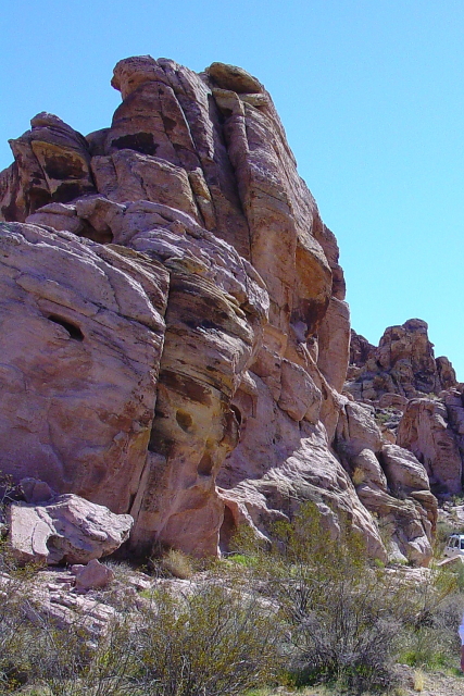
This hike goes through the Black Mountains and passes some interesting geological formations along the way. There are several pour-overs in the canyon and some people may want to use safety ropes to help descend the Class III drops. The last pour-over is not climbable without ropes, but by backtracking a short distance there is a side canyon that bypasses the pour-over and leads down to a small sand beach.
There are also Rockpeckers that live in the area and leave their holes throughout the canyon.
Sitting Bear and Poodle Rock are also located along the way.
The water level at Lake Mead is down about 140 feet from its highest point, but thanks to higher-than-average snow melt this spring there will not be any water rationing until at least 2020.
We even had a little Lady Bug join us for the hike!
It did not rain on us the entire day, but the storm clouds were always nearby.
BONUS PICTURE
When I was a Cub Scout leader, the Historic Railroad Tunnels were one of my favorite day hikes. Unfortunately, the trail is currently closed at Tunnel #3 due to deterioration of the tunnel support beams, but the trail remains open from both ends up to Tunnel #3.
In 1931 a railroad spur was built to haul equipment and supplies from Las Vegas-to-Boulder City and then on to the Hoover Dam construction site. In order to reach the site, a railroad grade was built using cut-and-fill when possible, but in five places tunnels had to be drilled through solid rock. When the dam was completed in 1935, the rail line was used for an number of years and then the spur line was abandoned in 1961, after the last generator was hauled to the power plant. Years later, the tracks were removed and the railroad grade was converted to a hiking trail.
Although the trail starts at Pacifica Way in Boulder City, most people start this hike at the Lake Mead National Recreation Area Alan Bible Visitor Center, which is located just outside of the Park entrance along U.S. Highway 93. From the Visitor Center parking lot, there are nice views of Lake Mead and the Marina at Hemenway Harbor.
Before the trail closure at Tunnel #3, it was possible to follow the old railroad grade and hike from the Alan Bible Visitor Center to the Hoover Dam Visitor Center. At the Hoover Dam end of the trail there is a metal bridge that connects the trail to the roof of the Hoover Dam Visitor Center parking structure.
If you don't like crowded day hikes, this hike can also be made at night. And, if you bring your own "campfire," you can even have S'mores at the end of the hike.
BONUS PICTURE