|
| Picture by Kolohe |
When we crossed from South Dakota into Nebraska, Kolohe looked at the map and questioned how I was going to find anything in northern Nebraska to write a blog about. I assured her that I would find something to write about because I love Small Town America!
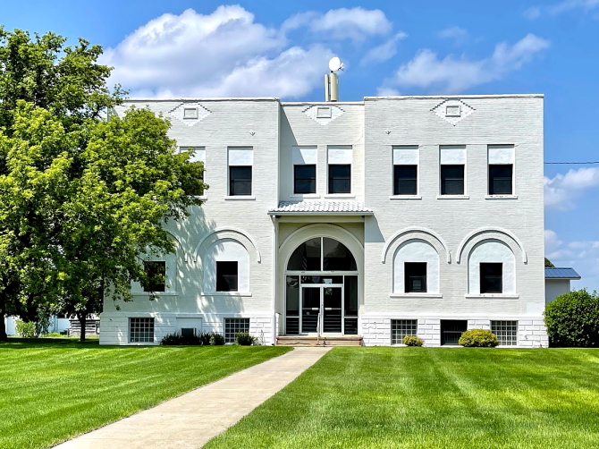
In Spencer (population 455) we tried to locate the historic Corn Exchange building; but we did not have an address and could not find a historic marker. Kolohe took a picture of a building that looked historic, so we decided to call it the historic Corn Exchange building because no one would probably ever know the difference.
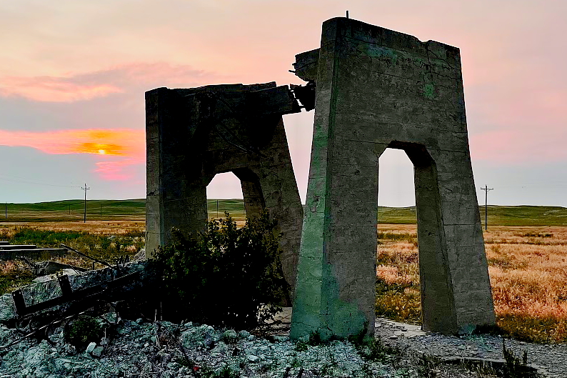
About 12 miles east of Spencer is where Lewis & Clark camped on September 7, 1804, at a place that is now known as "The Tower." It was at this location they discovered a great number of holes in the ground and little animals called "Prairie Dogs." They finally captured one of the animals by "poreing a great quantity of water in his hole" until he came out. Since they had never seen this type of animal before, the Prairie Dog was shipped back to Washington for scientific classification.
 |
| Picture by Kolohe |
 |
| Picture by Kolohe |
 |
| Picture b Kolohe |
Butte (population 326) was named for the small hills, or "buttes," near the town. In the early 1990s the US Government purchased land two miles west of town for the Central Interstate Low Level Radioactive Waste Compact. However, after a series of long court battles that ended in 2004, the Nebraska site was removed from consideration for the Compact.
 |
| Picture by Kolohe |
The largest single military air disaster in Nebraska occurred on August 3, 1944, just south of Naper (population 84). A C-47 military transport plane carrying twenty-eight men crashed in a ravine just south of town during a severe storm. There were no survivors. The men were on their way to the Army Air Force Base in Pierre, South Dakota, where they were scheduled to complete gunnery training before going overseas. There is a historic marker and a nice memorial to the airmen just outside of town.
Located south of Naper is the famous White Horse Ranch, which is where the American Albino Color Breed of horses originated. (Now known as the American Crème and White Horse Registry.) It is the only registered breed of livestock ever developed exclusively in Nebraska and has been deemed to be of national significance.
 |
| Picture by Kolohe |
It had been almost an hour since Kolohe had taken a picture, so we had to stop by an abandoned roadside park so that she could get her picture-taking fix by taking 25 or 30 pictures of an outhouse and a mailbox. Sophia and I found a nice shady spot and napped in the vehicle
 |
| Picture by Kolohe |
 |
| Picture by Kolohe |
Springview (population 242) was named for a spring near the town's center. Even though the spring dried up, they did not changed the name of the town.
There are a number of historical markers on the courthouse grounds, along with the first Keya Paha County High School building and a log cabin. Both buildings are now part of a museum operated by the county Historical Society.
 |
| Piicture by Kolohe |
 |
| Picture by Kolohe |
Long Pine (population 305) was once a major hub on the Chicago and North Western Railroad (C&NWRR). Located in Long Pine was a large roundhouse, turntable, and steam engine service facility. At its peak, five passenger trains per day stopped in Long Pine.
The rail line has now been abandoned in this part of Nebraska and is being converted into "The Cowboy Trail." When completed, the 321-mile trail will run from Chadron to Norfolk, making it the longest Rails-To-Trails conversion in the United States.
 |
| Picture by Kolohe |
Along the highway as it runs through Ainsworth (population 1,728), there are some interesting historic gas stations and the Sellors Barton Museum. Kolohe also found some flowers to take picture of while we kept driving around the block waiting for her. (We could not find a parking place because there was a street fair in the downtown area.) Before she finished taking pictures, the police were getting a little suspicious about an out-of-state vehicle continually cruising the area.
 |
| Picture by Kolohe |
 |
| Picture by Kolohe |
 |
| Picture by Kolohe |
 |
| Picture by Kolohe |
 |
| Picture by Kolohe |
 |
| Picture by Kolohe |
 |
| Picture by Kolohe |
 |
| Picture by Kolohe |
 |
| Picture by Kolohe |
 |
| Picture by Kolohe |
Just before driving into the county seat of Brewster (population 17), we passed an old wooden bridge that had collapsed into the North Loup River. A construction crew was working on the road and the flagman waved us through the construction area. Kolohe insisted she needed a picture of the old bridge, so we turned around and went back. When Kolohe jumped out of the vehicle just before reaching the construction area, the flagman was a little worried why someone with a camera was approaching him. He felt much better after she explained that she did not want to photograph him, but just wanted a picture of the old bridge.
 |
| Picture by Kolohe |
 |
| Picture by Kolohe |
 |
| Picture by Kolohe |
The community of Halsey has a population of 76. When searching the web for what there was to do in Halsey, it stated: "enjoy the acres of wide open spaces."
On the way out of town there was a large Adirondack chair that seemed to be well used. Then, we saw a strange figure coming though the trees that looked like Big Foot; so we hurried on our way.
 |
| Picture by Kolohe |
 |
| Picture by Kolohe |
 |
| Picture by Kolohe |
 |
| Picture by Kolohe |
 |
| Picture by Kolohe |
Thedford (population 211) was the location of a terrible tragedy on May 10, 1891. The Haumann sisters, Matilda (8 years old) and Henrietta (4 years old), became lost in the Sand Hills when walking home from a neighbor's house. A search party was formed the next day to look for the girls. Three days later they found Henrietta alive, 25 miles from her home; and a week later Matilda's lifeless body was found 75 miles away. In memory of the two girls, a statue has been erected on the courthouse lawn. Also, located around town are various other works of art.
 |
| Picture by Kolohe |
 |
| Picture by Kolohe |
 |
| Picture by Kolohe |
 |
| Picture by Kolohe |
 |
| Picture by Kolohe |
Along the highway west of town there were a number of windmills. Kolohe attempted to photograph them all, but we ran out of time.
 |
| Picture by Kolohe |
Mullen (population 509) is home to the Winter Polar Bear Tank Race, where teams race down the Middle Loup River in eight-foot stock tanks. Not much to do during the winter in a small town.
A time capsule was buried on the front lawn of the Hooker County Courthouse in 1989 and it is scheduled to be opened in 2039 (50 years). There was also an old picturesque grain elevator by the railroad tracks.
 |
| Picture by Kolohe |
 |
| Picture by Kolohe |
 |
| Picture by Kolohe |
 |
| Picture by Kolohe |
Hyannis (population 182) is the county seat for Grant County, which has a total population of 614 people. The county was reported to be one of the least populous county in the United States.
The Hotel DeFair in downtown Hyannis was built in 1898 and was once considered to be the best hotel and restaurant in western Nebraska
Ashby (almost a ghost town) was named by a railroad official after Ashby, Massachusetts.
 |
| Picture by Kolohe |
 |
| Picture by Kolohe |
 |
| Picture by Kolohe |
Ellsworth (population 32) was established in 1898 as a company town for the Spade Ranch.
At its peak in 1905, the massive Spade Ranch encompassed over 500,000 acres of land and had a herd of 60,000 cattle. The Spade Ranch is still in operation and their cattle brand resembles an Ace of Spades playing card. Also, located in Ellsworth is the Tri-State Cowboy Museum.
 |
| Picture by Kolohe |