I was driving down the Outer Loop this morning when I happened to look west and noted Turtle Head Peak in the distance. I thought to myself that maybe I should get up early tomorrow morning and hike to the top of the mountain for a RonnieAdventure!
Flashback! I let out a loud scream and let go of the steering wheel so that I could slap myself on both cheeks as hard as I could until I came to my senses. I suddenly remembered hiking Turtle Back Peak several years ago and said that I would never do that hike again.
The trail is located on the south-facing side of the mountain, so you get full sun load all the way to the top. There are no trees and very few places that you can even get in the shade to rest.
About half way up the steepest part of the incline, the trail disappears and you take two steps forward and slide back one on the loose gravel covering the hard surface. Lots of fun when the heat feels like 110 degrees Fahrenheit!
I remember when did this hike several years ago, we were on the lower part of the trail when we were passed by a young couple that had physiques like Cirque du Soleil performers. About an hour later we met them again on their way down the mountain and inquired about the time it required to get to the top. Needles to say, we were surprised when they told us that the trail was too steep and hard, so they turned around before reaching the top. Of course, that only made me more determined to reach the peak!
The trail started at the Sandstone Quarry in Red Rock National Conservation Area and it was a nice walk through the desert until the trail reached the Calico Tanks Junction. Because it was late spring there were lots of wildflowers along the trail to make the hike more enjoyable.
Of course, there are also a number of reptiles in the area that you need to watch out for! (One of the herpetology groups liked the rattlesnake picture so much they published it on their web site.)
After passing the Calico Tanks Junction, Turtle Head Peak appeared to be just a short distance on the other side of some sand hills; so, we assumed that this hike was going to be easier than planned.
Unfortunately, once on the other side of the sand hills, the peak was not as close as we had anticipated.
As the trail increased in elevation, the vegetation and the terrain started to change. Most trees and rocks that were higher than the surrounding objects showed evidence of numerous lightning strikes.
When we finally reached the saddle, we could see into Brownstone Canyon on the north side of Turtle Head Peak. It was interesting to view the Brownstone Canyon trails from above because I had just helped the BLM Wilderness Specialist GPS all of the trails in the area.
The top of the mountain was not a single peak, but more of a large flat area leading to a vertical drop on the south side of the mountain. Regardless, the views were spectacular!
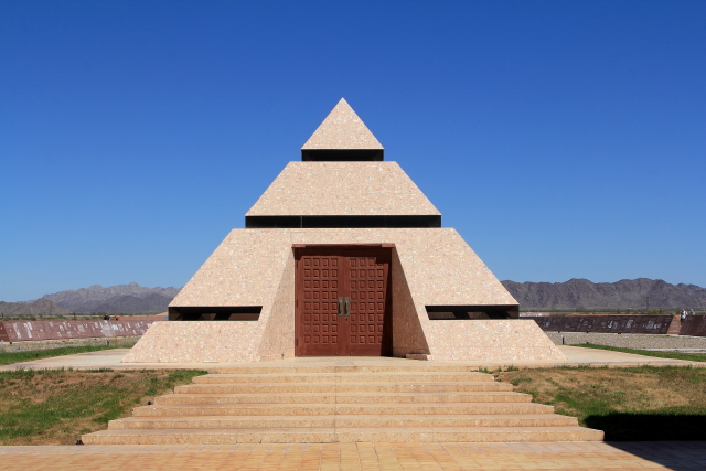
Many people are surprised when they learn that the "Center of the World" is located in Felicity, California, about 5 miles west of Yuma.
The "Official Center of the World" is a small dot located inside of a pyramid that has doors opening toward a church located on a distant hill. Between the pyramid and the church is the outdoor "Museum of History in Granite," which contains "Literacy for Millennia from Alpha to Omega."
 |
| Google Aerial Picture |
The Museum of History in Granite is a collection of 400 Missouri Red Granite panels that when completed will be a "record of humanity that will last for the millennia." Engraving is completed on a few panels each year, so currently the project is only about 25% completed. Some of the completed panels include History of Aviation, History of California, Earl Time Keeping, Salt and Paper, Magna Carta, and the Great Depression, just to name a few.
There are two other interesting on-site exhibits near the Center of the World. One is a sun dial with a casting of Michaelangelo's Sistine Chapel's Creation Arm used for the gnomon and the other exhibit is Section #12 of the original Eiffel Tower upper stairway.
The Eiffel Tower was constructed for the 1889 World Exposition in Paris, but over time the heavy iron upper stairway caused the tower to sway. So, in 1983 the stairway from the second level observation deck to the top of the tower was replaced with a lighter stairway. The original stairway was then cut into 20 sections and sold. Section #12 was purchased by Chateau de Cheverny, founding Mayor of Felicity, and shipped to Felicity to be used as an outdoor sculpture. It has been estimated that approximately 100 million visitors used the stairway between 1869 and 1983.
The Imperial Sand Dunes, located just west of Felicity, are popular with the ATV crowd and on the west side of the dunes it is still possible to see sections of the "Old Plank Road."
Before 1912 the only way to go from Phoenix to San Diego by automobile was to go north and bypass the Imperial Sand Dunes, or hire someone with a team of horses to pull your vehicle over the sand dunes. Since going north around the sand dunes added about 20 hours to the trip, in 1912 a plank road was constructed across the dunes and the road became known as "The Do-It-Yourself-Highway" because the shifting sand often undermined or covered the wooden planks. Shovels were sold at both end of the dunes so that motorist could clean and repair the road as needed. Although the plank road was only wide enough for one vehicle, at various locations there were pullouts for vehicles to pass.
Near the Old Plank Road is possible to see "The Wall," so we followed it to the border crossing at Nuevo Algodones.
Traveling north from Felicity there are a number of old mines and ghost towns just a short distance from the highway.
Obregon was the site of a 20-stamp mill, Cornish Rolls, a Harding Mill, and a floating plant that were used to extract gold from the local mines. The mines closed in 1939, but in 1989 American Girl Mining Joint Venture started an open pit mine at the Obregon location. Although the open pit mine is not open to the public, there is an Obregon historic marker near the highway.
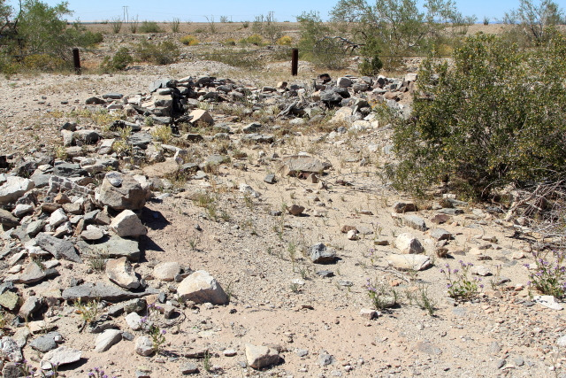
Gold was first discovered in the Tumco area by Spanish colonists, making it one of the oldest mining areas in California. By 1894 the area was part of a mining boom in southeast California; but unfortunately, the boom did not last long and by 1905 the mines were abandoned.
The U.S. Bureau of Land Management (BLM) now oversees the Tumco Historic Townsite and has established a self-guided walking trail that winds through the various historic residential, commercial, and mining areas. We followed part of the trail and found it to be very interesting.
There was a profusion of wildflowers in the area, which made the drive home more enjoyable.