
At the entrance to Bent's Old Fort there is a market indicating that the fort was located on the Mountain Route of the Santa Fe Trail. Vehicles are not allowed to drive to the fort replica, but a shuttle service is available for those not wanting to make the hike.


After the Louisiana Purchase in 1803, Americans started to move westward; but there were few services west of Independence, Missouri. So, in 1833 traders Charles and William Bent opened a fort on the bank of the Arkansas River, which a that time was unorganized territory and the boundary between the United States and Mexico. Bents fort was close enough to the Rockies to trade with trappers for beaver skins (called "hairy bank notes"); and also near the hunting grounds of the Cheyenne, Arapaho, Kiowa, and Comanche Indians to trade for buffalo skins. When traveling on the Santa Fe Trail, Bents Fort was the only place between Independence and Santa Fe to obtain service.
By 1846 the Fort was used for more than just trading. The government used the Fort as headquarters for the Upper Platte and Upper Arkansas Indian Agencies and also started stationing troops at the Fort in case of a Mexican invasion.
Charles Bent died in 1847 and there are various stories of what happened to the fort after that time. Some records indicate that William may have tried to sell the Fort to the government and when a sale could not be consummated he moved his business north to Fort Saint Vrain on the South Platte River. About the same time a cholera epidemic swept through the Indian Nations. Then, in 1852 William returned to Bents Old Fort, salvaged what he could, burned the fort and moved his business to Big Timbers, which is now near Lamar, Colorado.
The Fort was reconstructed in 1976 using archaeological excavations, paintings, original sketches, diaries, and other historical data. It is well worth a stop if you are ever in the area.


Eads (population 609) was the first high school in Colorado to provide notebook computers for each student and moved from a paper to a computer-based curriculum. A sculpture entitled "Kindred Spirits" by artist Shalah Perkins is on display with the following poem:
Their lives made Kindred Spirits
of these women of the west
They shared the pain and joy
of America's conquest
They prove their strength and courage
with raw intensity
Raised a family in the wild
through great adversity
I'm proud of every ounce of blood
that comes from them to me
The example of America
as it was and is to be.


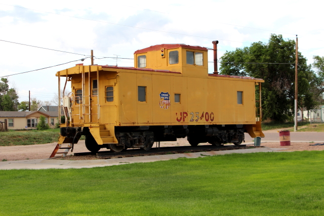
Kit Carson (population 233) was named for frontiersman Christopher Houston "Kit" Carson. The visitor center is located in the historic train depot and across the street is some interesting art work.
In 1872, "The Great Buffalo Hunt" occurred just north of town. The hunt was arranged for the Grand Duke Alexis of Russia and hosted by an escort party that included some of the West's most legendary people - General Philip H. Sheridan, Lt. Col. George Armstrong Custer, William F. "Buffalo Bill" Cody, and James Butler "Wild Bill" Hickok. The Grand Duke killed three buffalo, which reportedly greatly improved relations between Russia and the United States.


Archaeological evidence found at The Paint Mines south of Calhan (population 780) indicates that the area was occupied by Native American people from about 9,000 years ago. The colorful clay was used to create pottery and used as paint for ceremonial purposes. It is also believed that the clay "channels" were used to trap buffalo herds where they could easily be killed with bows and arrows.


Elbert (population 230) was almost totally destroyed in 1935 by a flood on Kiowa Creek that resulted in nine deaths. The flood water was 8-to-15 feet deep and destroyed all of the bridges and 59 buildings (three-fourths of the town's buildings). Most of the destroyed building were never rebuilt.


Kiowa (population 723) suffered from the same 1935 flood that destroyed three-fourths of Elbert.
The Elbert County Museum is located in the old Kiowa High School building that was constructed in 1920 and was one of the first buildings constructed in Colorado to consolidate all of the one-room school districts in the area. The building served as the regional high school until 1985, when it replaced with a larger, more modern facility.
There is a monument in front of the county courthouse that was erected by the Pioneer Women of Colorado in memory of the pioneers that were killed by Indian attacks in the area.


Elizabeth (population 1,358) was also severely affected by the 1935 flood because the railroad track were destroyed and the town suffered an economic loss for the next 30 years. The historic town is now the most populous municipality in Elbert County and is becoming a bedroom community to support Castle Rock.

Castle Rock (est. population of 55,747) is located about mid-way between Denver and Colorado Springs and is named for the castle shaped butte near the center of town. It is difficult to believe the population growth in the area because when we lived in Colorado over 50 years ago; Castle Rock was only a small community that supported a nearby Rhyolite quarry. Movie actress Amy Adams was born and raised in Castle Rock.

Driving back into Colorado Springs, we stopped by the ProRodeo Hall of Fame & Museum of the American Cowboy where there is a statue of "The Champ" Casey Tibbs in front of the building. A brochure states that "it is the only heritage center in the world devoted to professional rodeo."


In the same general area is the Rocky Mountain Motorcycle Museum and Hall of Fame. Anyone that likes motorcycles would enjoy visiting the museum to see all of the vintage and antique cycles that includes: Indian, Harley-Davidson, Excelsior, Ariel, Mustang, BSA, Honda, Cushman, Panther, and Triumph bikes that date from 1913 to 1983.


