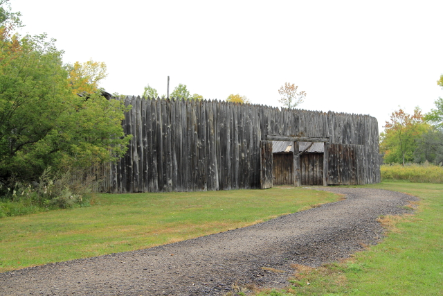
On a hill overlooking the Missouri River (across the river from Mobridge, South Dakota, about 40 miles south of Fort Yates) there is a monument and the alleged grave of Sitting Bull. A sign on the monument states that "Sitting Bull was originally buried at Fort Yates, ND. On April 8, 1953 surviving relatives with the aid of the Dakota Memorial Association moved his remains to the present location and dedicated the Memorial Burial Site April 11, 1953."
Sitting Bull (Tatanka Iyotake) was the son of Sitting Bull and Her Holy Door and was born near the place where he is now buried.
At the age of fourteen Tatanka Iyotake was part of a raiding party against the Crows and to honor his victorious return, his father Sitting Bull gave him his own name and his Father took the new name "Jumping Bull." Sitting Bull (the younger) became Chief of the Hunkpapa Tribe in 1857 and in 1876 Sitting Bull and Crazy Horse defeated General George Custer and the 7th Cavalry at the Battle of Little Big Horn in Montana. During his lifetime, Sitting Bull had five wives - Light Hair (died in childbirth), Snow-On-Her (divorced), Red Woman (died of sickness), and sisters Four Robes and Seen By The Nation.


Located on the same hill as the Sitting Bull grave marker, but set back from the River, is a monument to Sakakawea. A sign on the monument states that after returning from the East, "Charbonneau and Sakakawea settled down at Fort Manuel, about 30 miles north of here near Kenel, South Dakota. On December 20, 1812 it was recorded in the daily journal of events at the fort that Sakakawea died of a putrid fever. There is no further record of her but it is safe to assume that this remarkable woman's grave is somewhere near the site of Old Fort Manuel."

There is a beautiful City Park in Mobridge that contains a stone marker stating "Shetak captives rescued here November 1862 by Fool Soldier Band." No further explanation about the marker is presented.
Web postings indicates that on August 20, 1862 there were about 40 people living along the eastern shore of Lake Shetek, which was "the very edge of the frontier." Three bands of Dakota, led by Grizzly Bear, White Lodge, and Old Pawn, attacked the settlers and after several hours of fighting 15 settler were killed, three women and eight or nine children were captured. The remainder of the settlers escaped.
In November, at the risk of their own lives, a group of young Teton Lakota men (known as "Fool Soldiers" because they were pacifist dedicated to peace with the white-man) ransomed the remaining eight captives for food and goods and the captives were eventually reunited with their families.


As we were traveling across South Dakota I kept noticing the old grain elevators, many of which were closed and greatly depreciated. The grain elevators reminded me that when I was growing up in South Dakota many people were farmers and every little town had at least one grain elevator that was typically a tall, slender structure with a cupula on top and the buildings were almost all the same shade of gray. During harvest season, you would see trucks waiting to unload their grains lined up for blocks in front of the elevators.
Because most of these historic grain elevators are in the last few years of their lives, I decided to document their existence by recording pictures of the remaining elevators when I came across them in my travels.
Trail City had two old elevators that both appeared to be abandoned, but both were still standing.


The grain elevator in Timber Lake was in a little better condition and still appeared to be in use. (One of the most mystifying questions about Timber Lake is how the town got its name because there were very few trees in the area when the town was formed in 1910!)

The community of Firesteel received its name from the Sioux Indians that discovered when rocks (flint) found in the nearby creek were struck against steel, it made fire. However, Firesteel is best known as the only location in South Dakota that had a coal mine. Coal was mined commercially from 1911 until 1968.
Firesteel is now mostly deserted, but at one time it had a bank, Holt's Flour Mill, many businesses, 70 miles of rural telephone lines, and a light-plant that provided 24-hour service.


Lantry has a lot of steel grain bins, but the most interesting thing that I noticed in the community was the unusual historic water tower. The "new" water tower is a typical slender structure with a round ball at the top, but the historic structure is just a slender tower. In all of my travels, this is the first time that I have ever seen this water tower design.

Dupree has two historic grain elevators - one is abandoned and the other appears to be in fair condition, but still in use. There is also a restaurant on D Street that serves really great lunches.

The dinosaur scrap-iron sculpture in Faith is to "commemorate Sue, the largest, most complete and best preserved T-Rex found to date...only a foot, an arm and a few ribs and vertebrae are missing."
The dinosaur was named after Sue Hendrickson, who discovered the bones near Faith on August 12, 1990. After a lengthy legal battle, the Field Museum in Chicago purchased Sue on October 4, 1997 for $8.4 million.

Located between Maurine and Mud Butte is the Ben Ash Monument. A plaque on the monument states: "The Trail Blazers. Here on December 26, 1875 Ben Ash...on their trip from Bismarck through the Indian country first sighted the Black Hills." No other explanations for the monument are provided.
According to information on the Web, the Black Hills were probably first sighted by Francis and Louis-Joseph Verendry in 1743 when they stated in their journal that they were "...in sight of mountains;" but their Indian guides would not take them any closer.
Lewis & Clark heard tales about the Black Hills from trappers, but the trappers typically did not enter the Black Hills because the Hills were considered to be sacred by the Lakota Indians. In 1823 Jedediah Smith and his group of traders actually traveled through the Black Hills, but they did not stay because they did not want to cause trouble with the Indians.
Pressure to open the Black Hills to settlement was halted in 1868 when the lands west of the Missouri River were "granted to the Lakota in an effort to bring about lasting peace with the tribes of the plains. The treaty prohibited settlers or miners from entering the Hills without authorization, in return the Lakota agreed to cease hostilities against pioneers and people building the railroads."
By 1875 gold had been discovered in the Black Hills and it was estimated that about 800 miners were working claims in the Custer, Hill City, and Deadwood areas. By 1876 there were an estimated 10,000 non-Indian people living in the Black Hills.
Noting this rapid population expansion in the Black Hills, Bismarck merchants wanted a route for transporting gold miners and goods to Deadwood, so Ben Ash and a group of men called "The Trail Blazers" established a route that could be used for stagecoaches and wagons. On December 26, 1875, while marking the Bismarck-Deadwood Trail, Ben Ash first sighted the Black Hills.
In late 1876 a treaty was negotiated with the Indians that opened the Black Hills to Euro-Americans and the South Dakota territorial legislature quickly authorized construction of a road along Ben Ash's route from Bismarck to Deadwood.
The first stagecoaches left Bismarck on April 11, 1877 with sixty-eight passengers and soon the stagecoaches were running daily service between Bismarck and Deadwood. Freight wagons with over 200 teams of horses were also using the road to make trips between Bismarck and Deadwood.
However, the Bismarck-Deadwood transportation boom ended suddenly in 1880 when the railroad reached Pierre. It then became cheaper and faster to move goods to Pierre by train and then use wagons from Pierre to Deadwood.

For those readers that grew up in South Dakota, I'm ending with a South Dakota sunset that may help bring back many memories!