Sunday, January 27, 2013

RonnieAdventure #0038 – LBJ Ranch, Gillespie County, Texas

On a recent visit to Texas I stopped by the LBJ Ranch for a tour of the “Texas White House” during the Johnson administration; and much to my surprise, I couldn’t believe that the “Ranch” was a long, narrow strip of land containing only 1,570 acres. Why in Nevada, we call that a garden plot!

Most of the Ranch consists of a fenced airstrip for landing what LBJ referred to as "Air Force One-Half,” a Lockheed VC-140 JetStar that carried passengers between Austin (50 miles to the east) and the Ranch near Johnson City. In 2010 someone found the JetStar in an Air Force salvage yard in Tucson, so they had the plane refurbished and shipped to the Ranch where it is now on display.

There are a number of buildings on the Ranch that are available for viewing on a self-guided tour, including the LBJ Birthplace (reconstructed), the Junction School, Sam Johnson Home, the Show Barn, the Johnson Cemetery, the Texas White House (guided tour only), and a number of the Johnson family automobiles. Although LBJ attended the Junction School for a few months when he was four years old, the family moved down the road a bit to Johnson City where LBJ lived until he went to college. It was in the Johnson City elementary school where LBJ learned his 3-R’s – readin, ritin, and rithmetic!

The family home in Johnson City is also open for guided tours by the National Park Service. Two different movies are available for viewing in the visitor’s center -- One movie gives a summary of the Johnson White House years and the other movie (that I did not see) was reported to be about Lady Bird and Texas wildflowers.

Ya-all stayed tuned for some more Texas Adventures!
 
Visitor Center in Johnson City
 
Johnson House in Johnson City
 
"Texas White House" on LBJ Ranch
 
"Air Force One-Half"
 
LBJ's Lincoln Convertable
 
Junction School located on the LBJ Ranch


Friday, January 25, 2013

RonnieAdventure #0037 (Revision 1) - Highway 178, Roadside Geology, Inyo County, California

Fred H. sent me an email that confirms you can't trust everything that you read on the Internet or information that you get from geologists. Fred responded: "I have a book entitled Geology Underfoot in Death Valley and Owens Valley. There are 30 sites each of which gets a chapter with black and white photographs and an explanation. The third chapter discusses your specific spot which is called the Resting Springs Pass Volcanic Tuff. It is a formation of welded tuff. Basically it is gas-rich magma (mostly glass particles or pumice) explosively blown from a volcanic vent. When it hits the earth it is almost fluid-like and flows along the surface. If it is still very hot when it hits the ground, the residual heat melts glass which compacts and welds together (thus the name)."

Thanks for the information Fred!

Wednesday, January 16, 2013

RonnieAdventure #0037 – Highway 178, Roadside Geology, Inyo County, California


While 
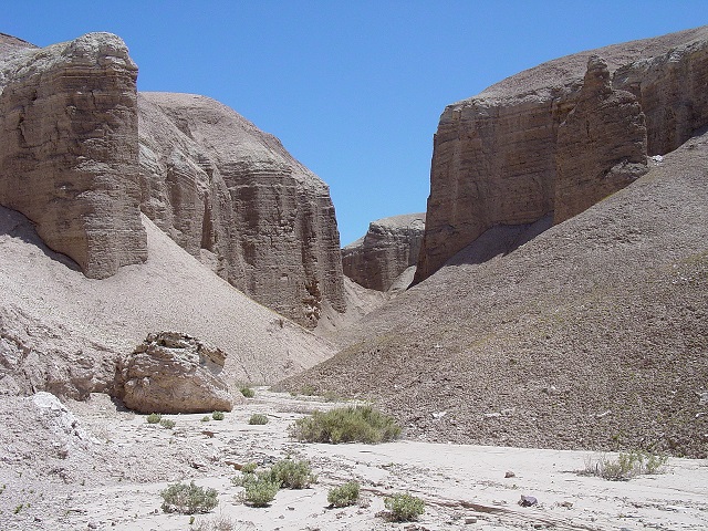
traveling east on State Highway 178, I was amazed at a geological formation that was visible along a road cut about four miles east of Shoshone, California. After taking some pictures at the site, when I returned home I started checking the Internet for information about what caused the unusual black streak through the road-cut rock formation. Much to my surprise, I found various theories on the Internet that varied from “It was caused by Superman when he dove through the Earth’s crust to stop an earthquake” to “It was caused by a meteorite when it struck the Earth.” Usually when I have a question about anything in the Mojave Desert, I always use Shortfuse (Bill Mann) as a reference, but this time I think Shortfuse got it wrong. (Bill has written six books detailing his extensive travels throughout the Mojave Desert and is usually considered a reliable source for anything unusual.)

People often ask how Bill got the nickname “Shotrfuse,” so some explanation may be in order. In the 1950s Bill was one of the few people roaming around the Mojave Desert that had a blasting license, so when the rock blasting business was slow he would take any jobs that were available. He blew up two railroad bridges (he said it was fortunate that he got the right ones), did demolition work, and worked on movie sets. On one movie set the dynamite charges kept going off before the cameramen were ready for the blast, so they started calling him “Shortfuse” and his wife “Dynamite.” The nicknames stuck!

Anyway, Shortfuse calls this the “Perlite Comet” site. He said that one time he picked up some of the black particles and put them in a campfire, but they didn’t burn like coal or pop as perlite does when heated. The rocks shine and sparkle when the sun is shining, but the particles are not black glass or obsidian.  Therefore, Shortfuse concluded that the shining particles are probably something from the perlite family, but maybe some unknown mineral.

When I did my research on the Internet, I found numerous theories about what did or did not cause the black streak. Some people say that the streak was not caused by a comet because comets are made of ice, so the streak would have been white. I also learned that astronomers have concluded that the streak was not caused by a meteorite because meteorites explode or cause a large crater when they collide with the Earth’s surface; thus, meteorites are not able to penetrate the Earth’s crust.  Advocates of the “Superman Theory” insist that this theory must be true because it was documented in a Superman movie. In the movie Lois Lane’s car falls into a crevasse caused by an earthquake in the Mojave Desert, so Superman goes back in time, dives through the Earth’s crust and supports the area under the Mojave Desert so that the earthquake does not ever occur. This looks like the spot in the movie where Superman dove through the Earth’s crust, so Superman advocated are convinced this theory must be true. The last theory investigated was the “Black Hole” theory, which advocates say has visual confirmation because the streak is black.

When I asked a geologist at work, he looked at the pictures and said that it was just an extinct volcanic vent. Well, so much for the Superman and black hole theories!

Thursday, January 10, 2013

RonnieAdventure #0036 – China Ranch, Inyo County, California

China Ranch is an oasis of water and greenery found in the Mojave Desert near Tecopa, California, and a great place to spend a day hiking and exploring the surrounding area. There are numerous hiking trails that start at the China Ranch general store and lead to many unique and fascination places. The geological formations in this area are spectacular, so when visiting the area it requires a large memory card for your digital camera! Parts of several movies have been filmed around China Ranch and if you saw the movie “The Sum of All Fears,” based on Tom Clancy’s book by the same name, this is where they discovered the atomic bomb!


The most popular hiking trails lead downstream from the store toward the old Tonopah and Tidewater Railroad Line (relatively intact in some places), the Amargosa River (a beautiful riparian corridor that empties into the lower part of Death Valley), and a small slot canyon. Each location is worth a hike based on its own merits. This area became internationally famous a few years ago when the U.S. Ambassador to Denmark visited China Ranch and hiked several of the trails.

Although archaeologists have dated human inhabitant bone fragments found in the area back 10,000 years, the first recorded European visitor was in the spring of 1830. A New Mexico horse trader named Antonio Armijo was developing a trail to move horses from California to Santa Fe and the trail he developed  passed by this area. His route later became known as the Old Spanish Trail. The route meandered from waterhole-to-waterhole and was often referred to as “the longest, crookedest, most arduous trail in the west.” This is the trail that Kit Carson followed when he was guiding the Freemont Party from California to Santa Fe. Although modern roads have covered most of the Old Spanish Trail, in many places it is still possible to see wagon ruts that were left by early travelers as they crossed through this area.

In about 1900 a Chinese man named Qu on Sing (aka Ah Foo) moved to the area after working in the Borax Mines in Death Valley for a number of years. He planted date trees and vegetables and raised cattle that he sold to the local miners. Over the years he became very prosperous and the area became known as Chainman’s Ranch. Then, as the story goes, one day a man named Morrison showed up, shot the Chinaman, and claimed the ranch as his own property. (Apparently, the local law enforcement agency did not investigate the death.)

The date trees thrived and the area is now known as China Ranch Date Farm. An informational sign at the store indicates that “the date palm is the oldest known cultivated tree crop, dating back to at least 6,000 B.C. in Mesopotamia (modern day Iraq)…Frequently cited in both the Bible and the Koran, the date palm has long been considered the tree of life in the middle east.” There are many varieties of dates and they vary widely in size, taste, color and moisture content. You can sample and/or purchase a large variety of different dates in the China Ranch general store. 

Throughout the area there are a large number of open mine shafts and pits, some of which are partially fenced and adjacent to the road. The mines in the main canyon leading to China Ranch were collectively known as the Gypsum Queen and between 1915 and 1918 they produced about 100,000 tons of gypsum. The ore was shipped to Los Angeles on the Tonopah and Tidewater Railroad and was used in the manufacturing of plaster. However, the mines were closed in 1918 after two miners were killed when part of the mine collapsed.

China Ranch areas that are open to the public include a general store, a museum, a few rental units, and the hiking trails.  Hiking trail guides are available at the general store. If you visit China Ranch, be sure to try the banana-date ice cream shake!
Road to China Ranch/Part of Gypsum Queen Mine
China Ranch General Store
China Ranch Mass Transit System
"Bottle Trees"
Hiking Trail
Canyon Hike
Lost Tourist Vehicle
One of numerous arches
Picture by Kolohe
Picture by Kolohe

Saturday, January 5, 2013

RonnieAdventure #0035 – Dublin Wash, Inyo County, California

It is not easy to find building materials when you live in the desert, so early miners in the Shoshone, California area decided to build an “underground” city by excavating room in the walls of the local washes. This area is ideally suited for such underground dwellings because there is a hard tufa cap that covers a soft volcanic ash that is easy to excavate. The largest concentration of rooms is located in Dublin Wash, just west of the Shoshone Cemetery in Inyo County, California. If you drive up (west) Dublin Wash, you can't miss the area -- just look for the large number of old rusty cans scattered about the area in front of the rooms.

There are many different versions of who built the first rooms and when the rooms were excavated, but the most plausible story seems to be that the first rooms were dug by Irish miners in the mid-to-late 1800s; hence, the name “Dublin Wash” or “Dublin City.”

The rooms are reported to be warm in the winter and cool in the summer, which is nice for year-round habitation.  Over the years the rooms were enlarged and many rooms were interconnected to accommodate growing families. In later years, some dwelling units were equipped with luxury items like stoves, stove vent pipes (still in existence), and ice boxes. However, when the mines played out, the miners deserted the area and the rooms were abandoned. The local residents report that after World War II the rooms were occupied by a less desirable crowd, but they too abandoned the rooms after a few years and left the area. The rooms are now vacant and it is a fun place to visit.

Since most of the washes surrounding Shoshone have similar soil types, over the years the underground room concept became popular and today vacated rooms can be found in numerous washes in the area. The other well-known area for rooms is located on the north side of California State Highway 178, adjacent to the east side of the Amargosa River. This area is called “Castles in the Clay," and one set of rooms were reportedly developed by Chief Tecopa; however, some local residents discount the story and think the rooms were just developed by other miners. The day we visited “Castles in the Clay,” someone had cut down the large trees that were in front of the “Chief Tecopa” rooms (historic photos show large trees by the entrance) and the door to the rooms was locked. You can't miss this set of rooms because they are very close to the highway and the only set of rooms that have a side window.

Also located at the mouth of Dublin Wash is the Shoshone Cemetery. This is an interesting historic cemetery with many unnamed grave sites marked only with old wooden crosses or just piles of rocks. Although some grave sites have been fenced, this is one place where the grass is definitely not greener on the other side of the fence! Of course, there is no grass on either side of the fence and there is very little vegetation of any type around the cemetery. May the residents rest in peace!

Dublin Wash/"Dublin City"

Dublin Wash/"Dublin City"
 
 "Castles in the Clay"
 
"Castles in the Clay"/"Chief Tecopa Rooms"

Shoshone Cemetery
 

 Shoshone Cemetery
 
 Shoshone Cemetery