Friday, September 24, 2021

RonnieAdventure #0483 - Pierre, South Dakota


I remember one hot, dry summer day in 1948 when my Mother told us kids that we were going to the Oahe Dam dedication ceremony. The Dam was going to be built across the Missouri River a few miles north of Pierre. We did not want to go -- but we did not have a choice. Mother told us that someday we would be thankful that we went because we could always say that we attended the Dam's dedication ceremony. 

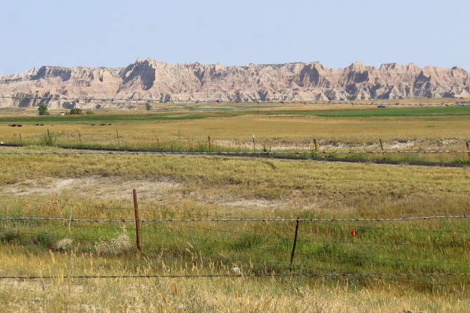
Reluctantly, we got in our 1946 Chevrolet and drove out across the prairie to a hill overlooking the Missouri River. There was a white sun shelter set up for dignitaries, but we were not dignitaries; so we had to stand out in the sun. The Governor and some guy named Rockefeller from back East gave long-winded speeches and then they turned over some dirt with shovels. When we looked at the distance across the Missouri River, we thought these people were crazy because it would not be possible to move enough dirt to fill in the large void between the two hills on opposite sides of the River (about 9,300 feet, or 1.76 miles). We were told that when the Dam was completed, it would be the largest Earth-rolled dam in the world. (There are now larger Earth filled dams in the world and the 200-mile long Lake Oahe is now the fourth-largest man-made lake in the United States.) 

Ten years later we were out in the Missouri River in an old green fiberglass fishing boat when all of the water started draining out of the River. They finally stopped the mighty Missouri! We loaded the boat on a trailer and drove out to a hill overlooking the Dam to watch as they continued filling in the large gap between the two partially completed sides of the dam.  

For most of the summer the River remained dry, except for some large depressions in the low areas of the river bottom that still had water. The depression areas looked like small stock ponds. Rain water kept the depressed areas full and there were a lot of fish in these areas, which made for great fishing that summer. I even caught a Sturgeon one time.

It was also fun to go fishing above the Dam. As the water level kept rising all of the trees along the River were flooded and it was possible to drive the boat between the trees. The trees eventually died and then there were just dead trees sticking out of the water. 

The water level behind the Dam was kept at a low level for several years while tunnels were drilled through the dam that would eventually house the power turbines. During this time period, water was released back into the river through what would become flood control tunnels after completion of the power generator tunnels. Fishing was amazing along the channel between the flood control tunnels and the River channel, so when I was in high school we spent a lot of time fishing along the channel. 

When not fishing we decided to see if we could learn to water ski. At that time water skis were made of heavy wood and much wider than current water skis, so it took a lot of arm strength to just get out of the water and be pulled behind a boat. Life jackets were not required and skiers just wore a 6-inch wide piece of foam around their waist, which really did not do anything as far as safety was concerned. Plus, the foam belt often fell off when you fell in the water while skiing. I think the belt was just so that they could find your body if you got knocked out and drowned, assuming the belt did not fall off. 

Our fishing boat had an outboard  25-hp Johnson engine that was mounted on the back of the boat. When traveling to the lake, the engine could be lifted off and placed in the back of the pickup, or it could be left on the boat if not traveling too far.

There was a handle on the engine that was used to control the direction and speed of the boat. The boat driver sat on a wooden bench next to the engine and to change the boat's direction, the driver moved the handle horizontally from side-to-side. If you wanted to go left, you moved the handle to the right. Boat speed was controlled by rotating the handle. 

The first time we tried pulling a water skier, the front of the boat came up out of the water because there was no weight in the front of the boat. After changing the engine angle and putting someone large in the front part of the boat, the front of the boat stayed in the water; but it greatly reduced the speed of the boat. Still, it worked and we learned to water ski. 

 I remember one time when we were going to Farm Island (an island in the Missouri River downriver from Pierre), the boat came loose from the pickup and fortunately went into the ditch without hitting anything. The trailer's tongue stuck in the ditch bank and the boat launched itself over the front of the trailer with the engine still attached, clearing a barbed wire fence and landing out in a field. We were able to take the fence apart and drag the boat back the the trailer, which was a little bent up but still useable. When we put the boat in the water there were no leaks and there were no problems with the engine. A few years later we purchased a new boat that had a steering wheel and a 40-hp Scott engine. 

Although all of the Dam's power tunnels were not yet all operational, President John F. Kennedy officially dedicated the Oahe Dam on August 17, 1962. The Dam was completed in 1964 at a total project cost of  $340,000,000. I had moved away from home in 1961, so I was not able to attend the dedication. 

When we were recently at the farm we drove from Pierre up to the Dam on Highway 1804 (east side of the river - the year Lewis & Clark went up the Missouri River), drove across the Dam , and then drove back to Fort Pierre on the west side of the River (Highway 1806 - the year Lewis & Clark came down the River). There are numerous historic markers on the west side of the River that explain the area's history, including the Verendrye Monument National Historic Landmark, Fort Pierre Chouteau National Historic Landmark, Lewis & Clark's camp site, and other historic events that happened in the area.   

There is now a visitor center located on top of the Dam, along with the historic Oahe Mission School and Chapel that was constructed in 1877. Originally, the Mission was located 11 miles upstream from its current location, but the original location is now under 150 feet of water. The Mission building has been well maintained and is now used for nondenominational religious services and marriages.


The flood control tunnels are not used anymore, but the channel that runs to the River still contains water. 


While in Pierre, Sophia's aunts told her that Zesto ice cream was healthy for you and you could eat a lot of it without gaining weight; so Sophia decided to give up food and survive on Zesto. 

Picture by Kolohe
Picture by Kolohe
Picture by Kolohe

After staying at the farm, Sophia decided she could be a farm girl. She especially loved all of the animals and soon became one of Bob's best friends. (After spending a winter in South Dakota, she may give up the farm girl idea.)

Picture by Kolohe
Picture b Kolohe
Picture by Kolohe
Picture b Kolohe
Picture by Kolohe
Picture by Kolohe
Picture by Kolohe
Picture by Kolohe
Picture by Kolohe
Picture by Kolohe


Friday, September 17, 2021

RonnieAdventure #0482 - Scenic, Allen, Martin, Parmelee, Mission, White river, Murdo, Vivian, South Dakota


About 60 years ago I spent part of one summer living and working on the Air Force Bomb Range south of Scenic (South Dakota). At that time Scenic was still an active community, but it is now considered to be a ghost town even though a few people still live there. The population of Scenic is listed as 10.

During WW II bomber flight crews were required to spend a certain amount of time practicing aerial gunnery by flying round the Range while shooting at targets. I was told that the flight crews really hated gunnery practice because it was very noisy and the guns had a vibration that was so severe it shook the entire plane and gave the entire crew a headache. Therefore, some of the flight crews just flew out to the Bomb Range, opened the airplane's bomb bay doors, and dumped all of the live ammunition out of the plane. After the War ended the live ammunition just laid out in the Badlands and people started finding it and taking it home for souvenirs. 

In the early 1960s the Air Force decided that they had better clean up the mess before someone was seriously injured or killed. Thus, a group of us from the Air Force spent part of the summer living in trailers while collecting and destroying the live ammunition that was spread around the Bomb Range. Since I was the medic assigned to the group, I was not qualified to handle explosives. I could hike with the group and look for munitions, but could not pick them up. Only the Explosive Ordinance Disposal (EOD) people were allowed to pick up and destroy the long strings of live ammunition. 

We once found a small bomb that had not exploded upon impact and the EOD people decided to destroy it where it was found, rather than move it to a different location. Some dynamite was placed on top of the bomb and when it exploded a piece of shrapnel went right over my head as I was filming the explosions with my 8 mm movie camera. (Actually, I was behind a dirt bank and just my head and movie camera were above the bank; but the shrapnel still made a whistling sound as it went over my head.)

On weekends we could go into Scenic for supplies at the general store and then go over to the Longhorn Saloon to get something to eat and play pool. I remember the pool table top was warped and the balls would sometimes roll to the center of the table, which made the game more interesting. At that time Sam 2 Bulls even had an art gallery in town.

Many saloons in South Dakota were still segregated in the early 1960s and Indians were not allowed in the buildings, but Scenic was a very progressive community and Indians were allowed to come inside to get something to drink. In the lower left corner of the sign above the door still visible is the notice "Indians Allowed." Also located on the lower right post in front of the building is a sign that says "No Parking Cab Stand," which seems humorous now. 

In the early 1960s part of the road from Rapid City to Scenic was still unpaved. When the Highway Department decided to pave the road I once again found myself in Scenic working for the Highway Department on a survey crew for the new road. (This time we lived in Rapid City and drove back-and-forth each day.) Most of my time was spent "blue-topping" stakes for the road grade, but we also worked on the alignment for future sections of the road that were to be completed at some future date. 

I am still amazed that some of the buildings in Scenic are still standing because they were about to fall down 60 years ago. There is not much now happening in Scenic, but I am told that Scenic is a popular stopping spot for people on their way to the annual Sturgis Motorcycle Rally. 


After leaving Scenic we drove south because I wanted to go by the North American Continent Pole of Inaccessibility that is located near Allen (South Dakota) on the Pine Ridge Indian Reservation. The Pole is not marked on any maps and non-Indians are not allowed to trespass on Reservation lands to find the spot, but there is a dirt road that passes within 0.5 miles of the location. (Wikipedia defines the Pole of Inaccessibility as "the center of the largest circle that can be drawn within an area of interest without encountering a coast." The Pole is 1,650 miles from the nearest coastline - a long way to go for a day at the beach.)

I stopped and took a picture where I thought the Pole was located; but I later discovered that I took the picture about 2.3 miles northeast of where I should have been. I did, however, drive within 0.5 miles of the Pole location, which was the closest road access. 

Just northwest of Allen we found a roadside marker the stated: 

A fatal crash occurred one mile southwest of this marker in a wheat field on January 17, 1944 at 11 P.M. The B-17 bomber and its crew was attached to the Second Air Force Command...at Ellsworth AFB, Rapid City, South Dakota. On a night-time routine bombing training mission, an emergency landing was attempted on a predesigned emergency grassed landing area. It would have been successful if the plane had not overshot the grass area and ended up in a wheat field. Four officers and three enlisted men were killed in the crash and fire which followed.  


Allen (population 420) is located on the Pine Ridge Indian Reservation. The annual median household family income is $3,819, which is considered to be the poorest place in the United States.

Allen Elementary School
Parmelee (population 562) is within the Rosebud Indian Reservation and was originally named "Cut Meat" because cows were butchered there at a packing plant. Somehow "Cut Meat, South Dakota" does not sound too appealing, so the town's name was changed to Parmelee. 

The west side of the Reservation is the dividing line for Mountain and Central time zones and when we entered the Reservation Sophia just happened to notice that her phone had changed from Mountain to Standard time. She wanted to see if the phone changed exactly on the line, so I had to twice drive back over the line to see if her phone changed time exactly on the line - it did not!

Picture by Kolohe
Picture b Kolohe
Mission (population 1,182) is the largest incorporated community in Todd County and received its name because there were several Indian missions located in the area. The town is now home of Sinte Gleska University. 

The University was named for the great Indian Chief Sinte Gleska (aka. Chief Spotted Tail), who was the son of Tangle Hair and Walks With The Pipe. He was born about 1823-24 and originally named Jumping Buffalo, but because he always wore a raccoon skin talisman, he became known as Spotted Tail. When he was 15 years old he got into trouble after drinking whiskey, so he pledged that he would never again drink alcohol. Throughout his life he kept his pledge. 

In 1854 Chief Sinte Gleska was part of the band of Indians that killed Lt. Grattan at Conquering Bear's camp. He immediately fled the area, but later decided to surrendered at Fort Laramie to stop the killing of innocent Indians. For his part in the killing, he went to prison, but his life changed when President Pierce pardoned him. After his pardon, Chief Sinte Gleska devoted the rest of his life to bring peace to his people. He worked with the missionaries to start Indian Schools because he wanted all of the Indian children to be educated. 

Chief Sinte Gleska was a signer of the Treaty of 1868 that created the Great Sioux Reservation and in 1877 he was the person that talked Chief Crazy Horse into surrendering. 

In 1881 Chief Sinte Gleska was elected to lead a delegation to Washington and on the way home he met Crow Dog along the road and Crow Dog "shot him off of his horse." No one knows for certain the murder reason, but some reported that it was over a woman and others say the dispute was over different political beliefs. Chief Sinte Gleska (Spotted Tail) was buried on the Rosebud Reservation southwest of Mission.

The most famous recent person to come from Mission was Bob Barker, former host of The Price is Right. Barker was 1/8 Sioux Indian and grew up in Mission where his mother was a teacher on the Reservation. 

Picture by Kolohe
Sinte Gleska University
Picture by Kolohe

White River (population 581) is the county seat for Mellette County and appears to have a very bombastic Public Relations Department. On the internet it stated:

Started in 1912 in White River as a community celebration, Frontier Days continues today as a yearly event and attracts people from around the world. Frontier Days will be held August 20-22, 2021, celebrating 110 years of thrilling rodeo action. The rodeo features all of the major events and includes a Ranch Bronc Ride. Also incorporated into the celebration are a parade, rodeo and a traditional Lakota Wacipi.


Murdo (population 488) was founded as a railroad town because it was about halfway between Rapid City and Mitchell. During its boom days there was a roundhouse, railyard, and passenger station. Now, the main attraction is the World Famous Pioneer Auto Museum, as seen on American Pickers. The Museum's trademark is a stretched Nash that is a popular photo stop with tourist. 

At the nearby campground I saw a restored Chevrolet Suburban with a kayak on the roof and rear FENDER SKIRTS. That is the first time I have ever seen fender skirts on a Suburban. I did not even know Suburban fender skirts existed!


Most people that grew up in Central South Dakota during the 1950s and 1960s knows where the town of Vivian is Located. Located in town was an old building (probably an armory) that that was used to host rock-and-roll dances. My brother-in-law had a band and his band occasionally played in Vivian. On this trip we stopped in Vivian, but I could not find the old building. It was probably demolished or burned down.

Vivian also holds the record for the Worlds Largest Hailstone, which measured at 8-inches in diameter and weighed 1.93 pounds.

On the way out of town we noticed some unique his-and-hers bathtubs that could be used to faster get ready for the Saturday night dances.


Picture by Kolohe
Arriving at the Farm near Pierre, we found the ferocious, attack watchdog Bob ever alert and standing guard over the place, protecting it from intruders. 


Friday, September 10, 2021

RonnieAdventure #0481 - Gering, Agate Fossil Beds, Fort Robinson, Crawford, Chadron, Nebraska

Picture by Kolohe
Picture by Kolohe
We stopped at a Standard station in Gering (Nebraska) to get gas and I could not believe it -- gas was just 21-cents per gallon! Unfortunately, the gas station was closed. 

When I was in high school one of my best friend's family owned a Standard Station. In those days all service stations were full service. If I happened to be there when a customer drove in I would help fill the car with gas, check the oil, wash the windows, and set the car's tires' air pressure. Service stations attendants also changed engine oil, greased linkages and rotating parts, washed/waxed cars, did vehicle mechanical work, sold tires, and put on tire chains in the winter.

Flat tires were common and they would let me fix my own tires using their equipment. All tires had inner tubes, so to fix a flat tire I first had to take the tire and inner tube off of the wheel, patch the inner tube, and then reassemble the unit. Inner tubes were repaired with "hot" patches, which required clamping a patch on the tube and then lighting the top of the patch on fire so that the patch would adhere to the tube. In later years "cold" patches were used on the inner tube and applied with a special adhesive.

Scotts Bluff National Monument is located just outside of Gering. A historic marker outside of the Visitor Center indicated that in 1860-1861 the Pony Express passed through here on their way to a station at Fort Mitchell, about 2.5 miles to the northwest. 

Most of the westward trails passed by Courthouse rock and Chimney Rock on their way to Scotts Bluff, all of which were landmarks used by the early pioneers. The Mormon Trail did not pass any of these landmarks because at this point it was still on the north side of the Platte River and did not cross the River and join the Oregon and other trails until it reached Fort Laramie. 

Picture by Kolohe
Picture by Kolohe
Picture b Kolohe
Scotts Bluff - Picture b Kolohe


While at the Oregon Trail Museum and Visitor Center we watched a movie about Scotts Bluff and it turned out the Park Ranger that narrated the movie was working in the Visitor Center that day. He was an interesting person and while we were visiting with him he told us that located in the Visitor Center was the largest collection in the world of William Henry Jackson paintings. Most people miss the exhibit because it is located around the corner from the main part of the museum. After our visit we went over and looked at the Jackson exhibit and were really amazed at details in his paintings.

Picture of painting by William Henry Jackson
In the 1930s the Civilian Conservation Corps (CCC) built a road leading to the top of Scotts Bluff and the road is still in use today. The road passes through three different tunnels on the way to the top.

Picture  by Kolohe
Picture by Kolohe
Picture by Kolohe

Agate Fossil Beds National Monument is located about an hours drive north of Gering. The fossils found here are from the Cenozoic Era, which is after the dinosaurs went extinct. It is believed that this area was once a water hole and as the water dried up, animals got stuck in the mud and died; thus, a large number of bones are found on top of each other. 

Picture by Kolohe


Picture by Kolohe
Picture by Kolohe


Daemonelix ("Devil's Corkscrew")
Paleocastor Rodent Skeleton
Also located at the Visitor Center is the Cook Collection of American Indian Artifacts. 

James Cook was a frontiersman that first met Chief Red Cloud in 1874 when he came to Nebraska leading a professor from Yale University that was looking for fossils. Cook and Red Cloud became good friends and over the years Red Cloud gave Cook many Indian artifacts that have now been donated to the National Park Service for display at Agate Fossil Beds National Monument. 


Picture by Kolohe
Picture by Kolohe
In addition to land animals in the area, large Paleocastor rodents lived in underground dens and their tunnels and burrows can still be seen today along a one-mile trail that loops around some of the formations. The Paleocastors dug corkscrews tunnels to underground dens and then later the tunnels and dens were filled with other materials. The "fossilized" tunnels called Daemonelix ("Devil's Corkscrew") are found as workers carefully remove dirt from around the fragile corkscrews. 

The Rattlesnakes are frequently found in this area, so it was recommended that hikers stay on the trail. 

Picture by Kolohe
Picture by Kolohe


An informational sign along the trail stated that the rock formation shown below is the remains of a 22 million year old sand dune that is one of the oldest land forms in the Niobrara Valley. 


Picture of Informational Sign - Artist Unknown
Picture by Kolohe

Historical photograph of worker carefully removing a Daemonelix - Photographer Unknown 

The former 22,000-acre Fort Robinson U.S. Army Fort is now a Nebraska State Park with dual management. Some of the individual buildings are under the supervision of the State Office of History Nebraska and other buildings are operated by the University of Nebraska.

Located on the parade grounds directly across from the Post Headquarters are two stone markers - one for "First Lieutenant Levi H. Robinson who made the supreme sacrifice February 9, 1874 in the Winning of the West" and the other marker is for "Chief Crazy Horse Oolala War-Chief of the Sioux Nation killed near this spot September 6, 1877."

Many of the Fort's historic buildings are rented to the general public and the Fort has been named "one of the nation's top family reunion spots" by USA Today. From personal experience, I can confirm that they have one of the best restaurants in the western part of Nebraska. 


Picture by Kolohe

Picture by Kolohe
Picture by Kolohe

Picture by Kolohe
Picture by Kolohe
Crawford (Nebraska) is just east of Fort Robinson and was named for Captain Emmet Crawford, who was stationed at the Fort. In a City park there is an old log cabin, a railroad caboose, and a really large Adirondack chair.


Picture b Kolohe
Picture by Kolohe
Picture by Kolohe
East of Chadron (Nebraska) is the Museum of the Fur Trade, which is located on the site of the original 1837 James Bordeaux's Trading Post. The Museum's logo is a fox inside of a circle, which "originally served as an inspector's mark on guns made for the Indian trade, appearing on the lock and the barrel. It served to inform the Indian customer that the firearm was of good quality." In 1842 a Flintlock gun could be purchased for 5 buffalo robes. The price for 50 bullets and 1 pound of powder was 1 buffalo robe.  


Picture by Kolohe

Picture by Kolohe
Picture by Kolohe
Picture by Kolohe
Picture b Kolohe
Picture by Kolohe
Picture by Kolohe
Picture by Kolohe
Picture by Kolohe

Outside of the museum there is a structure with the following informational sign:
The building before you is a faithful reconstruction of the original 1837 structure which collapsed about 1880. It was rebuilt with local hand-hewn timbers following archeological excavations and with information from eyewitnesses who visited the post when it was operating. The stream flowing in front of the post is Bordeaux Creek, named in honor of James Bordeaux, the trader who operated the post during its peak years.
Picture b Kolohe

Picture by Kolohe
A reproduction of an 1837 era warehouse used to store supplies is located near the trading post. 

Picture by Kolohe
An informational sign provided the following description of the Robe Press shown below:
In an average winter, the Bordeaux Post took in a thousand well-tanned buffalo robes...To facilitate storage, shipping, and accounting, the robes were baled into bundles of ten. Each robe was folded to 2-foot by 3-foot size, hair inside. Then ten were stacked under the raised bar. Several men pressed the bar down while another worker pulled ropes tight around the bale and tied them.

Picture by Kolohe

Picture b Kolohe