Friday, November 24, 2017

RonnieAdventure #0283 - Lewis & Clark Park (Washington) to Home


Lewis and Clark State Park (Washington) would be a really nice place to camp for a few days; unfortunately, we needed to change our plans and return to Las Vegas by a faster route. We did, however, have time to walk around the park and noted a number of unfamiliar plants. The Park Ranger was kind enough to write down the names of all the plants for us, but I lost the notes on the way home, so I'll just include a few plant pictures from the park.


Waitsburg (population 1,217) is a small city in Walla Walla County and is the only city in the State of Washington that still operates under its original territorial charter.


On the evening of October 16, 1805 Lewis and Clark arrived at the confluence of the Columbia and Snake Rivers and found hundreds of Indian camped there because it was the height of the annual salmon run. The native people gathered to welcome the explorers and Clark recorded that "...a Chief came from their Camp...at the head of about 200 men Singing and beeting on their drums...keeping time to the musik they formed a half circle around us and Sung for Some time." Clark recorded that the Native people considered them to be friendly because Sacagawea's presence signaled "...our friendly intentions, as no woman ever accompanies a war party of Indians in this quarter."

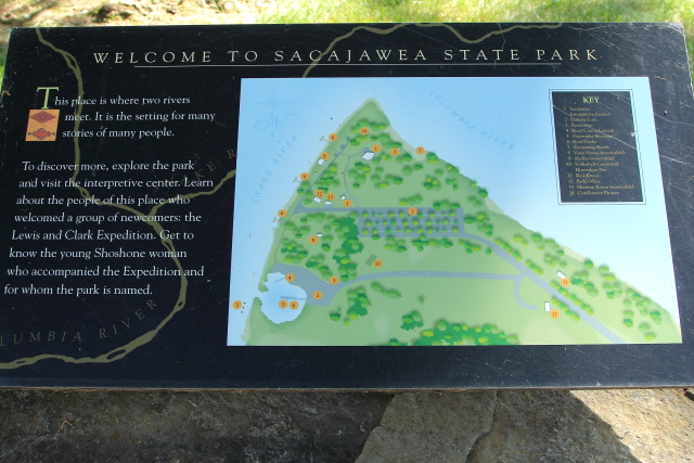
There are Lewis and Clark displays throughout the 284-acre park and there is a Sacagawea Interpretive Center that features exhibits about her and her contribution to the Corps of Discovery.


Looking Toward The Pacific Ocean
Looking Up The Snake River
Looking Up The Columbia River
I found out that if you want a tour of the Manhattan Project B Reactor at the Hanford site in Richland, Washington, the museum is not where it is located on the State map and you can not just show up for a tour. Thanks to GPS we were finally able to locate the actual visitor center (not shown on the State map) and watched a movie about the project, since we did not have advanced reservations for a tour. 


When we entered Oregon at Hermiston, we were greeted by two very large tin men. With such large watchmen looking over the city, we decided that this would be a safe place to camp for the night.


Arriving back in Pendleton, we decided that this would be a good time to tour the Pendleton Woolen Mills. It was really an interesting tour and when we saw all of the looms working we thought of Suzanne working on her loom. Of course, the tour ended in the gift shop!


The Tamastslikt Cultural Institute is a 45,000 square foot building located on the Umatilla Indian Reservation and it is the only Native American museum located along the Oregon Trail. The mission of the Institute is "to preserve and perpetuate the diverse cultures and histories of the indigenous people now known as the Cayuse, Umatilla, and Walla Walla Tribes" and "To educate people about our cultures, histories, and contemporary lives." Unfortunately, no photography was allowed in the museum.


La Grande (population 13,082) is the county seat of Union County, Oregon. The city is located along the Oregon Trail and was first settled in 1861 by the Brown family. As other settlers moved into the area the community was known as Brownsville, but there was already a town named Brownsville in Linn County, so in order to establish a post office the name was changed to La Grand in 1863. The entire downtown commercial district is now listed on the National Register of Historic Places.


The National Historic Oregon Trail Interpretive Center is located five miles east of Baker City, Oregon. The center contains numerous exhibits, hands-on displays, living history demonstrations, interpretive programs, hiking trails, and historic structures. It is possible to hike up Flagstaff Hill (part of the Oregon Trail) from State Route 86, then join a loop trail that leads to the visitor center. Or, for those that would prefer not to suffer some of the same hardships at the early pioneers, there is also a serpentine paved road to the top of the hill.


Rattlesnake Springs (Exit 335 from Interstate 84) was a major stop on the Oregon Trail. Unfortunately, when the automobile road system was developed across western Unite States, most of the roads followed the historic trails used by the pioneers and the original trails were paved over. Rattlesnake Springs is now a rest stop along Interstate 84. The campground that historically was filled with covered wagons has been converted into is an automobile  parking lot and there is a historic marker located over the springs.


Friday, November 17, 2017

RonnieAdventure #0282 - Lewis and Clark Country


Idaho historical marker #176 states that Lewiston was named the first Idaho Territory Capital on July 10, 1863, and the first two legislatures met here. In 1863, when Lewistion was the Capital, the Territory was a large area that included Idaho, Montana, and almost all of Wyoming. In 1864, Montana was established as a separate territory and most of Wyoming became part of Dakota Territory, so the Capital of Idaho was moved to Boise, where is is still located.

Located across the street from the first Capitol building is Lewiston's oldest surviving residence, which was built in the 1860s.


There are a number of art objects in downtown Lewiston, including statues, paintings, and various sculptures. There is even a large "wave" constructed from old canoes that is located adjacent to the river.


There are a series of locks and dams on the Snake and Columbia Rivers, so Lewiston is reachable by smaller ocean-going vessels. Port Lewiston is Idaho's only seaport and is the farthest inland port east of the West Coast of the United States.  


Tsceminicum, which means "Meeting-of-the-Water" in the Nez Perce language, was the historic name for the confluence of the Snake and Clearwater Rivers. In 2004 the old concrete marker was replaced with a new bronze sculpture that was manufactured in the Valley Bronze Factory in Joseph, Oregon. The front of the sculpture is a fountain and "interprets Native American mythology with a symbolic Earth Mother figure whose body sustains all forms of life and from whose hands the rivers run."(The fountain waters flow from the sculpture's hands.)


The Lewis-Clark State College is located on a hill overlooking downtown Lewistion and each May the college hosts athletes from across the United States to compete in the Avista-NAIA World Series. There are a number of sculptures relating to the Corps of Discovery on campus and there is also a nice fountain of Sacajawea in a park just off campus.


The Lewis and Clark Discovery Center is located in Hells Gate State Park just south of Lewison. There are numerous Corps of Discovery exhibits at the visitor center, but we found the stories of the some of the lessor known people that helped Lewis and Clark to be very interesting.


Weetxuwiis a little known Nimiipuu (Nez Perce) Indian woman that may have changed the course of history.

When Weetxuwiis was a young women she was captured by an enemy tribe and traded to a French man who took her to live in the Great Lakes area with other white people (Soyopos). The Soyopos treated her well and she eventually returned to live with her own people.

When the Corps of Discovery arrived on the Weippe Prairie in the company of Indians from the Shoshone Tribe (an enemy of the Pimiipuu), the Nimiipuu thought is was a trick of the Shoshone and were going to kill all of them until Weetxuwiis pleaded with the Chief to "do them no harm." She explained that she had lived among the Soyopos and they were good people, so the Nimiipuu helped the Corps of Discovery complete their mission without harm.


According to Nez Perce elders, "Before anyone can remember...a long time ago...before the human beings came...there was Mother Earth and Father Sky. All things come from them...all things...all beings...everything. This land and sky has provided food, shelter and clothing for our ancestors for many thousands of years. It still gives the gifts of salmon, elk, deer, moose, the gifts of bitterroot, cous, qemes, and a large variety of berries. These gifts are to be taken care of by not taking too much or certainly not polluting or destroying them. The promise is that if we take care of the gifts, they will take care of us. Only when we treat this earth as our Mother and the sky as our Father, can we find the healing so needed. Only when we treat this great earth as a part of our body, will we be able to understand her as Our Mother. And only then can we see all people as one...brothers and sisters with one Mother and one Father."


Also located in the Park is the Jack O'Connor Hunting Heritage & Education Center. Most men over 60 years of age that grew up in western United States will remember Jack O'Connor as a prolific hunter and writer for Outdoor Life magazine.  Jack traveled the world hunting big game animals and was one of the first people to complete the "Grand Slam of Wild Sheep." 


The jet boat trip up the Snake River through Hells Cnyon has been on my bucket list for about 40 years, so while we in Lewiston I decided that this was the time to make the trip. Most people in kayaks and rubber rafts come down the river, but with a jet boat we were able to go up the river, turn around and then come back down the river in the same day. We were assured that the boats were perfectly safe going up the river because most of the jet boats in service around the world are manufactured in Lewiston, Idaho. (The jet boats manufactured in Lewiston are in use on every continent around the world, except Antarctica.) No foreign manufactured boats used here!


A short distance from the marina we passed by some rock formations that reminded me of Devils Postpile National Monument in California. 


Next stop was a rock covered with petroglyphs and many of the carvings appeared to be of aliens from outer space.


After bouncing around in the boat for a couple hours, it was great to stop at the Garden Creek Ranch for a snack and a restroom break.The deer and wild turkeys that hang around the ranch really liked the apple orchard.


Continuing our journey up river, we spotted a number of Desert Bighorn Sheep by the side of the river. They apparently see so many people that they are not camera shy.


Even the White Tail Deer were not camera shy!


There were a number of old mines along the river and we were told that one shaft went completely through the mountain and came out on the other side.


Idaho is located on the east side of the Snake River and Washington/Oregon are on the west side. There is an old rock marker at the Washington/Oregon state line. 


At some locations, the river appeared to be very shallow, but the boat driver told us that a jet boat only draws about 8-inches of water and there are no props to brake as you go over the rocks.


On the way back down the river we stopped at the historic Cache Creek Ranger Station to use the facilities and watch all of the wild turkeys that call the nice green grass their home.


After a good night's rest, we enjoyed visiting an antique auto rally. In order to officially be in the rally, the vehicle had to be manufactured before 1918; consequently, most of the vehicles were manufactured in 1917.


After spending three days in Lewston/Clarkeston, we headed west into the state of Washington on US Highway 12 toward Pomeroy (population 1,425). Pomeroy is the county seat of Garfield County and the only city in the entire county.

In 1805 Lewis and Clark were the first caucasians to pass through Pomeroy while following an old Nez Perce trail. In later years, several groups followed the same trail and started settling in the area, so on February 3, 1886, the community of Pomeroy was officially incorporated. A 10-block section of downtown Pomeroy has now been placed on the National Historic Register.

Just outside of Pomeroy, in the small unincorporated community of Pataha, there is a nice collection of iron sculptures to welcome tourist to the area.