Friday, November 27, 2020

RonnieAdventure #0440 - Beaver, Utah


Beaver (population 3,112) is located along Interstate 15 about 200 miles south of Salt lake City. 

Before settlers arrived in the area, the lands were populated with various Indian tribes, including Fremont, Archaic, and Paiute. It was reported that Paiute Indians inhabited the area well before the Dominguez-Escalante Expedition passed through the region in 1776.

In 1847 Mormon pioneers established a trade route between Salt Lake City and Los Angeles, which at that time was still part of Alta California, Mexico. The trade route passed just south of Beaver and became known as the Mormon Road. Later the Mormon Road became known as the Southern Route of the California Trail.

In 1856 Mormon pioneers settled the Beaver area as part of a network of communities that were about a days ride apart by horseback (about 30 miles). Beaver was located about half way between Palivant Valley and Parowan Valley.

In 1858 the population grew quickly when numerous people migrated from San Bernardino ,California, to the Beaver area. Most of the people were engaged in raising livestock, but a sawmill and gristmill were built on North Creek and a woolen mill, a tannery, and a dairy were started in or near the settlement.

In 1872 the US Army established Fort Cameron near Beaver to protect the isolated area residents from Indian raids. The fort was active for 11 years and then decommissioned in 1883. Philo T. Farnsworth and John R. Murdock arranged for the property to be converted to the Beaver Branch of Brigham Young Academy (now Brigham Young University); however, eventually the Academy was closed and the school in Beaver was sold to a private party. The new owner razed the property, except for one building that was converted to a private residence.


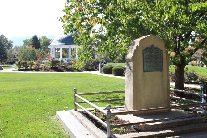
In the early part of the 20th century a hydroelectric plant was built on the Beaver River east of Beaver and Beaver became the first town in Utah to be electrified. The hydroelectric plant is still in operation today. I did not drive out to the original hydroelectric plant, but there is also a small operational hydroelectric plant located near the golf course that also still generates electricity.

The golf course hydroelectric plant was constructed in 1904 and power from the plant was available every evening from dusk until 10 PM, and one morning each week for household purposes. For special events and dances, power was available until midnight. Cost of the power was 7 cents per KWH.


Two notable people were born near Beaver - Robert LeRoy Parker, who went on to become the notorious outlaw known as Butch Cassidy; and Philo T. Farnsworth, who went on to become the "Father of Television" by inventing several critical electronic devices that made television possible. Farnsworth was also the first person to create table-top nuclear fusion. The log cabin where it is believed Farnsworth was born and a statue of Farnsworth are located outside of the historic Beaver County Courthouse.


Adjacent to the Farnsworth cabin is a wagon reproduction of the type used by the Mormon Pioneers that traveled westward. During the Sesquicentennial two mules named "Ruth and Ruby" recreated the journey by pulling the wagon from Omaha, Nebraska, to Salt Lake City, Utah. The 1,000 mile journey took three months.  


The historic Main Street buildings are still mostly in use with Beaver Sport & Pawn occupying over 8,000 square-feet of space. It is one of the easiest buildings to find in Beaver because there are two large murals painted on the north side of the building.


When entering Beaver from the south, there are two historic markers adjacent to the highway. The first marker describes an Indian raid on the Lee Ranch on October 27, 1866. Two of the children escaped from the ranch and alerted the Militiamen in Beaver, but the Indians called off the attack before armed men arrived to help the Lee's. 


The second historic marker noted that this was the spot where the first Beaver pioneers camped when they settled in Beaver. The site is now used for a parking lot and storage facility. 


The historic Beaver Stake Tabernacle was located on a site that is now a downtown park. The original building was torn down, but the Daughters of Utah Pioneers recreated the building that is now used for their museum. 


Beaver's Historic Opera House was constructed in 1908 using the finest materials available because the board of directors said "...nothing is too good for the people of Beaver..."  Over the years many famous people have performed at the Opera House. 


There is a nice Veterans Memorial with several monuments and military artillery located adjacent to the Utah National Guard Armory in the historic part of downtown Beaver. 


Before leaving Beaver, visitors are encouraged to fill their water containers because Beaver has the "Best tasting water in the United States." In 2006 the National Rural Water Association hosted an event to determine where the best tasting water in the United States was located. The "Great American Water Taste" was held in Washington, D.C. and a panel of judges from around the country sampled water from over 700 different locations and found Beaver to be #1 in the United States.

BONUS PICTURE

During the COVID-19 pandemic if you are remodeling your house and don't own a pickup, you can always move your materials by strapping them to the back of your car. Actually, you might be better off borrowing your neighbor's pickup.  


Friday, November 20, 2020

RonnieAdventure #0439, American Fork, Utah

American Fork (population 26,263) was settled in 1850 by Mormon Pioneers. The settlement was originally known as "Lake City" because of its proximity to Utah Lake; however, in order to avoid confusion with "Salt Lake City," in 1860 the community's name was changed to "American Fork." The town's name was selected because the American Fork River runs through the area. 

In 1852 there were tensions between the settlers and Indians, so construction of a fort was started along the American Fork River to protect the settlers from possible Indian attacks. The fort was designed to contained an enclosed area that was 80 Rods by 74 Rods, which was an area large enough to house all of the area residents at that time. The original plans for the fort called for 12-foot high walls, but none of the walls were ever built to that height. In 1855 the plans were modified to enlarge the fort's enclosed area using logs made of poured clay, but only a 1.270 foot-long wall was ever constructed. Nothing remains of the fort today.

The site of the original fort is now known as Robinson Park, which is located on State Street. For movie buffs, Robinson Park is where they shot the carnival scenes in The Sandlot (1992) movie. Parts of the movie Footloose (1984), and other lesser known movies were also filmed in and around American Fork. 

One monument in Robinson Park states that in February of 1866 the Territorial Legislature authorized the levy of a tax to support public schools. The majority of the citizens in American Fork approved the tax and in the fall of 1867 the first public school opened; thus, "American Fork thereby became torch bearer of the present free school system."

Another monument contains the following poem in honor of Sgt. Cory Wride:

Boys play loudly at courage, conquering
imaginary enemies in glorious battle.
They do not know that, when they are 
men and foes are real, their courage will
likely be quiet and their glory too often 
found in ultimate sacrifice, willing
but unsought. In the shadow of such
sacrifice, it is for us, beyond our
weeping, to remember the boy, honor
the man, and forgive the foe. 

Although there is no monument in the Park, during WW II Columbia Steel build a large plant in American Fork to support the War effort. This steel plant greatly increased that area's population and the City still holds an annual "Steel Days" celebration to honor the mill and the economic support the mill brought to the community. The Columbia Steel plant closed in 2001.

The Daughters of Utah Pioneers Museum is located in the Park, but it was not open on the day I visited American Fork. However, a number of their exhibits could be viewed through the fence surrounding the Museum.


The City Library is also located in Robinson Park and is housed in a building with some nice art work. 


The original City Hall building is located on a site that has been used for civic offices since 1861. A plaque on the front of the building states that "This building was designed...in 1903. Its Victorian Romanesque Revival style is characterized by round arched openings and a rough stone foundation. The roof is topped with a small central deck which was once adorned with a wooden belfry that was removed in 1959." The building is not open to the public; however there is a humorous grave stone on the front lawn that states: "American Fork. Born 1850 Died 1949. Victim of Parking Meter Plague."

Since the building is not open to the public, someone needs to remind the City to turn off their lawn sprinklers when the temperature drops below the freezing level. One tree was so laden with ice that several branches had broken.


There was also a really large chickens running around the City - they must be getting ready for Thanksgiving.

 BONUS HUMOR


Friday, November 13, 2020

RonnieAdventure #438 - Draper, Utah

DRAPER, UTAH (Population 48,319)


Draper is located along South Willow Creek and was originally called "Sivogah," which is the Indian name for "Willows." 

In 1852 the town's name was changed to Draperville and later the name was shortened to just Draper. As with most small town in the area, in 1854 a small fort was started to protect settlers from Indian Raids, but the fort was never completed and the Indian raids did not ever occur. The original fort site is now the location of Draper Historical Park, which contains numerous monuments and statures to honor early pioneers that settled in the area. 

An interesting bit of history is that in the 1940s Draper was known as the "Egg Basket of Utah" because so many eggs were produced by the local farmers. The eggs were marketed coast-to-coast and during WW II some eggs were supplied to military troops in the South Pacific. One poultry farm that was operated by Bruce Washburn had over 10,000 chickens. 


The Sorensen Home Museum is located adjacent to the Park, but it was not open on the day I visited Draper. 


Also not open was the Draper Historical Society Museum, but they did have a number of outdoor displays that I could visit.


The Old Draper School Building has now been renovated and contains office and retail uses. They did a really nice job on the renovation.


When leaving Draper, I noticed some interesting art work under the Interstate and railroad overpasses. I could not take many pictures of the artwork because the traffic was really heavy and I had to stand in the roadway to take the pictures. Some friendly natives even honked their horns to greet me as they about ran over me while I was standing in the road taking pictures.  


BONUS PICTURES

I was out in California this week and saw some really strange things. No! I mean more strange than usual. I think the COVID-19 virus has caused some type of ion dissociation that is affecting the sunlight. I'm not a scientist, but it appeared to me that when analyzing the dissociation equation the sunlight constant Kd has impacted the van 't Hoff factor causing distorted diffractions as sun rays strike solid objects. In other words, shadows from solid objects appear to be different than the objects themselves. This same phenomenon was observed at night, so moonbeams must also be affected. What is even stranger is that sometimes there is a shadow when there is no solid object! The shadow appeared to be growing out of a hole in the sidewalk. I'm attaching some pictures to show what I observed.