Sunday, December 30, 2012

RonnieAdventure #0034 – Pearl Street, Boulder, Colorado

During the holiday season I visited Pearl Street in Boulder, Colorado, with all of the quaint little shops decorated for Christmas and owned by interesting people. While in one shop, I started visiting with the shop owner and I happened to mention that the Christmas lights decorating the trees along the walking mall were very beautiful. She gave me a puzzled look and explained that the lights were not “decorations,” they were “tree warmers.” I must have looked puzzled, because she explained that trees are very fragile and they need tender, loving care to survive. She went on to explain that the reason people all along the mall were hugging trees is because the temperature was below freezing that evening and the people were afraid that the trees might get cold and die. Apparently, early in the fall there was a sheet posted at the old Court House where one could sign up for half-hour blocks of time to hug a tree all night, but this year there were so many applicants that wanted a time slot, all of the spots for the entire winter were filled within the first few hours of the posting. Next year, to have more equality, they plan to have a lottery to give more people a chance to get a time slot. (It should be noted that not everyone in Boulder is eligible to sign up for these openings or enter the lottery next year. To be eligible, applicants must have demonstrated previous tree hugging experience or have a PhD in Tree Hugging from CU or UC Berkeley.)

Because of my lack of knowledge about tree hugging, the woman must have suspected that I wasn’t a local and asked me where I was from. When I said “Nevada,” she gasped and asked how we managed to survive in such a hostile environment with no trees. She said that her family had never been to Nevada because they were afraid that without trees, there would be a lack of oxygen and they wouldn’t be able to breathe. I said that it wasn’t any different than in South Dakota where I grew up. However, I explained that when I lived in South Dakota we had tumble weeds that grew to be the size of trees. As a matter of fact, the tumbleweeds along the farm fences were so large that we had to cut them down with an ax. She looked a little skeptical, but continued the conversation by asking if we had ever tried planting any trees to produce more oxygen. I told her that one time when I was a kid I did plant a tree, but my brother thought that it was a tumbleweed and drove over it with a tractor. She said that was the saddest story she had ever heard and then burst into tears and started sobbing!

As I started to leave, she said that she had enjoyed our visit and she could see in my eyes that I was a kind person and would make an excellent tree hugger. She then told me that her family was part of the Chipko Movement and planned to attend the annual convention to be held in the Garhwal Himalayas of Uttarakhand next summer. She said that tree huggers from all over the world would be there and I should bring my family and attend the conference. I burst into tears and started sobbing!


Friday, December 21, 2012

RonnieAdventure #0033 – Peoples Canyon, Yavapai County, Arizona

When I received an invitation from the property owner to accompany him and several other people on a trip through Peoples Canyon in northwest Arizona, how could I decline the offer! Peoples Canyon is a privately owned in-holding within the Arrastra Mountain Wilderness Area, surrounded by State and Federal lands; thus, permission from the land owner is required to make this hike.

The weather was projected to be clear and sunny with temperatures in the mid-to-high 70s -- What a great time for a RonnieAdventure! Since a number of people were invited on the outing, it was decided to meet at a small dirt trail that runs west from US Highway 93 about 30 miles south of Wikieup. I was the only one that had not previously made the hike, but I was assured that the dirt trail was easy to find.

The morning of the hike I arrived in the general area about 15 minutes late and, of course, could not find the dirt trail or any of the other hikers. I decided that I needed to travel a little farther south, so I continued on my journey but did not find a dirt trail until I had traveled about five miles. Then, when I did locate a dirt trail, it was blocked by a locked gate. I continued searching the area, but no other dirt trails could be found. So, I presumed everyone must have left without me and decided to head for home.

As I passed the original area where we were to meet, I happened to notice some vehicles parked in a dry wash about 500 feet distant from the highway. Instinctively, I turned around and noticed a small dirt trail leading to the dry wash that was partially concealed by Palo Verde Trees, which kept me from seeing the dirt trail the first time I passed by the area. Traveling down the dry wash, I found everyone waiting for me, wondering where I had been. So much for meeting by the highway!

Fortunately, I was driving a Chevy Blazer because the three miles from the highway to the trail head was over a really, really nasty dirt trail that required a high-clearance 4-WD vehicle. We decided that from the wilderness boundary trailhead we would make about a five mile hiking loop that would enter Peoples Canyon about a mile upstream from the springs we were looking for so that we could see some Native American pictographs painted on the ceiling of a cave.

The trip through the canyon was spectacular and we were surprised at the amount of water flowing from the springs in mid-December. The only bad thing about hiking to the springs was that it was all downhill from the trailhead, so the trip out was all uphill! However, the hike out was very enjoyable because Peoples Canyon is located in the Sonoran Desert, which has substantially different plant materials than the Mojave Desert around Las Vegas.

Except for scraping the bottom of the vehicle on a few rocks on the way out, and adding some desert pin-stripping to the paint job, the trip home was uneventful. Now, I just have to return again when I have more time to explore the surrounding area.
 
Trail to Peoples Canyon
  
Peoples Canyon
  
Native American Pictographs
 
Peoples Canyon
 
Peoples Canyon
 
Peoples Canyon
 
Peoples Canyon
 
Peoples Canyon
 
Peoples Canyon
 
Peoples Canyon
 
Staghorn Cholla Cactus
 
Hiker On Trail Out / Saguaro Cactus
 
Palo Verde Tree
 
Prickly-Pear Cactus


Friday, December 14, 2012

RonnieAdventure #0032 – Crystal Wash Rock Art, Lincoln County, Nevada

Although I have driven by the Crystal Wash Rock Art site many times, I have never taken the time to stop for a RonnieAdventure!

The Crystal Wash Rock Art site is actually a network of several interrelated petroglyph sites with many different designs at each site. The sites are located along the north side of U.S. Highway 93 about 3 miles east of Nevada State Route 318, in Lincoln County, or about 38 miles west of Caliente.

The sites are easy to find because there are mile markers along U.S. Highway 93. Traveling east toward Caliente, about 0.2 miles past highway mile marker 54, park on the graded area on the right (south) side of the road and walk north across the highway toward a fence and two white painted boulders. After crossing the fence, continue walking north toward a large wash (about 200-300 feet). There is a BLM information box located on the edge of the wash that should contain maps describing the trail to the petroglyphs and information on the various petroglyph panels. In the event that there are no maps in the information box, follow the wash northeast for about 0.2 miles and watch for numbered markers on both sides of the wash. This area is called the “Entrance Site.”

Sites 5 and 6 (located on the right side of the wash as you are walking north) are very interesting. Site 5 is a boulder with a hole through it and the roof of the hole has been painted with red ochre, a pigment made from iron oxide. The significance of the painted roof is unknown because there are no other designs on the rock.

Site 6 is a petroglyph panel depicting zoomorphs (mountain sheep and other quadrupeds) and anthropomorph (people). It is also the panel that is illustrated on the front of the trail brochure.

Entrance Site - Petroglyphs at Marker #6 

To find the “Main Site,” go back to the highway and continue an additional 0.8 miles on U.S. Highway 93 toward Caliente. At Mile marker 55, turn north and go through a gate. Stay left (do not follow the trail that parallels the highway) for 0.1 miles and then turn right for about 0.5 miles to the end of the road. There is a BLM information box on the right side of the parking area with trail maps and approximate locations of the petroglyph panels.

If there are no maps in the box, follow the wash southwest (downstream) for about 0.2 miles and watch for numbered markers. Marker #2 starts on the south (left) side of the first large rock with petroglyph panels and the trail then makes a clockwise loop through the rock maze, arriving back in the wash just upstream from trail marker #2. If you cannot see the next numbered marker, watch for the many rock cairns that have been erected along the route.  

Site 8 is the panel illustrated on the front of the trail brochure. If you visit these sites, remember to take nothing but pictures and leave nothing but footprints!
 
Trail Marker at Main Site
 
Main Site Petroglyph Panel
 
Main Site Petroglyph Panel
 
Main Site Petroglyph Panel
 
Main Site Petroglyph Panel
 
Main Site Petroglyph Panel


Saturday, December 8, 2012

RonnieAdventure #0031 – Lost Creek Trail, Red Rock Canyon NCA, Clark Co., Nevada

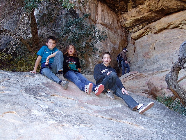
When you are responsible for watching the Grandkids all afternoon where do you go  -- The Lost Creek Trail at Red Rock Canyon National Conservation Area (RRCNCA)! The advantages of this  hike is that it can easily be expanded to include the Children’s Discovery Trail and the Willow Springs Loop Trail. This combination of trails takes more time and leads you past Native American pictographs, an agave roasting pit, and a small waterfall. Unfortunately, the waterfall only has a substantial water flow during the late winter and early spring months and the water flow is only a trickle at this time of year. The hike is not very strenuous, but there are plenty of rocks for kids to climb.

The best place to start the hike is at the Willow Springs Picnic Area parking lot. The agave roasting pit and some Native American pictographs are on the east side of the road (look for the large interpretive signs), while the hiking trails and waterfall are to the west.

The hiking trails in this area are narrow and wind through various patches of scrub Oak, Manzanita bushes, and other desert plants that closely line the one-track paths. Following the signs to the waterfall, the trail passes several areas used by rock climbers, so it is fun to stop and watch as climbers slowly make their way up the sheer rock faces. A little farther down the trail are some more Native American pictographs and shortly thereafter the trail splits with the right fork going to “Tunnel Arch” and the waterfall and the left fork returning to the parking lot. The ultimate destination, of course, is “Tunnel Arch” and the waterfall.

When we arrived at the waterfall, there was only a light dribble of water falling from the falls, but it still kept the rocks wet and slippery. Another attraction at the waterfall is “slide rock,” which all kids (and some adults) have to slide down to wear out the seat of their pants. (This is only allowed when the mothers are not along on the hike.)   

On the way back to the car, we followed a plank walkway across the marshy areas below the waterfall and then walked in a dry stream bed back up the canyon to the parking lot where we had left our car. A great time was had by all!

Willow Springs Loop Trail 
Willow Springs Loop Trail
Two young hikers holding up a large rock
Native American Pictographs
Waterfall during early winter months
Waterfall Area
"Slide Rock"
"Tunnel Arch"
Wooden Plank Walkway
Young hiker
Dry wash back to parking lot.