 |
| Picture by Kolohe |
 |
| Picture by Kolohe |
We stopped at a Standard station in Gering (Nebraska) to get gas and I could not believe it -- gas was just 21-cents per gallon! Unfortunately, the gas station was closed.
When I was in high school one of my best friend's family owned a Standard Station. In those days all service stations were full service. If I happened to be there when a customer drove in I would help fill the car with gas, check the oil, wash the windows, and set the car's tires' air pressure. Service stations attendants also changed engine oil, greased linkages and rotating parts, washed/waxed cars, did vehicle mechanical work, sold tires, and put on tire chains in the winter.
Flat tires were common and they would let me fix my own tires using their equipment. All tires had inner tubes, so to fix a flat tire I first had to take the tire and inner tube off of the wheel, patch the inner tube, and then reassemble the unit. Inner tubes were repaired with "hot" patches, which required clamping a patch on the tube and then lighting the top of the patch on fire so that the patch would adhere to the tube. In later years "cold" patches were used on the inner tube and applied with a special adhesive.
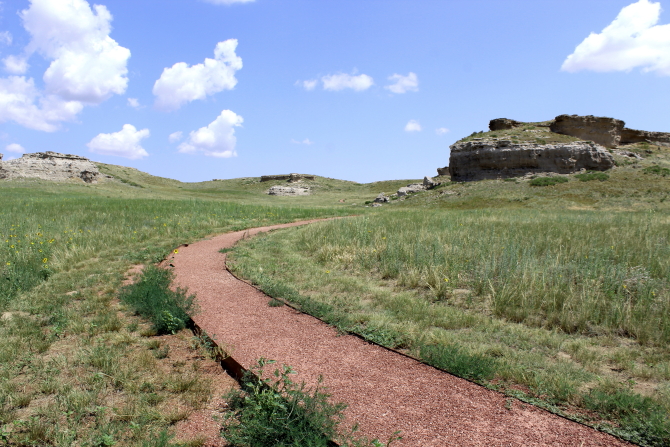
Scotts Bluff National Monument is located just outside of Gering. A historic marker outside of the Visitor Center indicated that in 1860-1861 the Pony Express passed through here on their way to a station at Fort Mitchell, about 2.5 miles to the northwest.
Most of the westward trails passed by Courthouse rock and Chimney Rock on their way to Scotts Bluff, all of which were landmarks used by the early pioneers. The Mormon Trail did not pass any of these landmarks because at this point it was still on the north side of the Platte River and did not cross the River and join the Oregon and other trails until it reached Fort Laramie.
 |
| Picture by Kolohe |
 |
| Picture by Kolohe |
 |
| Picture b Kolohe |
 |
| Scotts Bluff - Picture b Kolohe |
While at the Oregon Trail Museum and Visitor Center we watched a movie about Scotts Bluff and it turned out the Park Ranger that narrated the movie was working in the Visitor Center that day. He was an interesting person and while we were visiting with him he told us that located in the Visitor Center was the largest collection in the world of William Henry Jackson paintings. Most people miss the exhibit because it is located around the corner from the main part of the museum. After our visit we went over and looked at the Jackson exhibit and were really amazed at details in his paintings.
 |
| Picture of painting by William Henry Jackson |
 |
| Picture of painting by William Henry Jackson |
In the 1930s the Civilian Conservation Corps (CCC) built a road leading to the top of Scotts Bluff and the road is still in use today. The road passes through three different tunnels on the way to the top.
 |
| Picture by Kolohe |
 |
| Picture by Kolohe |
 |
| Picture by Kolohe |
Agate Fossil Beds National Monument is located about an hours drive north of Gering. The fossils found here are from the Cenozoic Era, which is after the dinosaurs went extinct. It is believed that this area was once a water hole and as the water dried up, animals got stuck in the mud and died; thus, a large number of bones are found on top of each other.
 |
| Picture by Kolohe |
 |
| Picture by Kolohe |
 |
| Picture by Kolohe |
 |
| Daemonelix ("Devil's Corkscrew") |
 |
| Paleocastor Rodent Skeleton |
Also located at the Visitor Center is the Cook Collection of American Indian Artifacts.
James Cook was a frontiersman that first met Chief Red Cloud in 1874 when he came to Nebraska leading a professor from Yale University that was looking for fossils. Cook and Red Cloud became good friends and over the years Red Cloud gave Cook many Indian artifacts that have now been donated to the National Park Service for display at Agate Fossil Beds National Monument.
 |
| Picture by Kolohe |
 |
| Picture by Kolohe |
In addition to land animals in the area, large Paleocastor rodents lived in underground dens and their tunnels and burrows can still be seen today along a one-mile trail that loops around some of the formations. The Paleocastors dug corkscrews tunnels to underground dens and then later the tunnels and dens were filled with other materials. The "fossilized" tunnels called Daemonelix ("Devil's Corkscrew") are found as workers carefully remove dirt from around the fragile corkscrews.
The Rattlesnakes are frequently found in this area, so it was recommended that hikers stay on the trail.
 |
| Picture by Kolohe |
 |
| Picture by Kolohe |
An informational sign along the trail stated that the rock formation shown below is the remains of a 22 million year old sand dune that is one of the oldest land forms in the Niobrara Valley.
 |
| Picture of Informational Sign - Artist Unknown |
 |
| Picture by Kolohe |
Historical photograph of worker carefully removing a Daemonelix - Photographer Unknown
The former 22,000-acre Fort Robinson U.S. Army Fort is now a Nebraska State Park with dual management. Some of the individual buildings are under the supervision of the State Office of History Nebraska and other buildings are operated by the University of Nebraska. |
Located on the parade grounds directly across from the Post Headquarters are two stone markers - one for "First Lieutenant Levi H. Robinson who made the supreme sacrifice February 9, 1874 in the Winning of the West" and the other marker is for "Chief Crazy Horse Oolala War-Chief of the Sioux Nation killed near this spot September 6, 1877."
Many of the Fort's historic buildings are rented to the general public and the Fort has been named "one of the nation's top family reunion spots" by USA Today. From personal experience, I can confirm that they have one of the best restaurants in the western part of Nebraska.
 |
| Picture by Kolohe |
 |
| Picture by Kolohe |
 |
| Picture by Kolohe |
 |
| Picture by Kolohe |
 |
| Picture by Kolohe |
Crawford (Nebraska) is just east of Fort Robinson and was named for Captain Emmet Crawford, who was stationed at the Fort. In a City park there is an old log cabin, a railroad caboose, and a really large Adirondack chair.
 |
| Picture b Kolohe |
 |
| Picture by Kolohe |
 |
| Picture by Kolohe |
East of Chadron (Nebraska) is the Museum of the Fur Trade, which is located on the site of the original 1837 James Bordeaux's Trading Post. The Museum's logo is a fox inside of a circle, which "originally served as an inspector's mark on guns made for the Indian trade, appearing on the lock and the barrel. It served to inform the Indian customer that the firearm was of good quality." In 1842 a Flintlock gun could be purchased for 5 buffalo robes. The price for 50 bullets and 1 pound of powder was 1 buffalo robe.
 |
| Picture by Kolohe |
 |
| Picture by Kolohe |
 |
| Picture by Kolohe |
 |
| Picture by Kolohe |
 |
| Picture b Kolohe |
 |
| Picture by Kolohe |
 |
| Picture by Kolohe |
 |
| Picture by Kolohe |
 |
| Picture by Kolohe |
Outside of the museum there is a structure with the following informational sign:
The building before you is a faithful reconstruction of the original 1837 structure which collapsed about 1880. It was rebuilt with local hand-hewn timbers following archeological excavations and with information from eyewitnesses who visited the post when it was operating. The stream flowing in front of the post is Bordeaux Creek, named in honor of James Bordeaux, the trader who operated the post during its peak years.
 |
| Picture b Kolohe |
 |
| Picture by Kolohe |
A reproduction of an 1837 era warehouse used to store supplies is located near the trading post.
 |
| Picture by Kolohe |
An informational sign provided the following description of the Robe Press shown below:
In an average winter, the Bordeaux Post took in a thousand well-tanned buffalo robes...To facilitate storage, shipping, and accounting, the robes were baled into bundles of ten. Each robe was folded to 2-foot by 3-foot size, hair inside. Then ten were stacked under the raised bar. Several men pressed the bar down while another worker pulled ropes tight around the bale and tied them.
 |
| Picture by Kolohe |
 |
| Picture b Kolohe |


No comments:
Post a Comment