 |
| Ground being leveled for new construction on right |
 |
| New water detention basin on left. |
 |
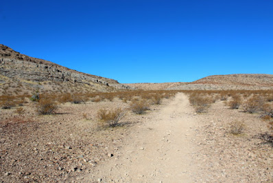
| Part of hiking trail used as a road. |
 |
| Alternate trail that bypasses housing areas |
 |
| View North From Mountain Top |
 |
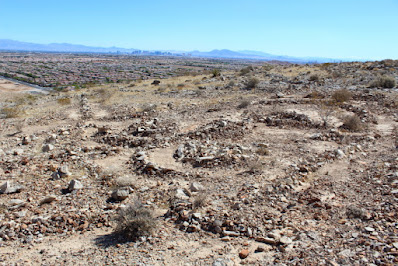
| View South From Mountain Top |
AND NOW, THE REST OF THE STORY
Just when I thought it was safe to go back outside, I read in the newspaper that two Interstellar objects that came from different star systems had been discovered passing the Earth - Oumuamua (Hawaiian for "Scout") and 21/Borisov. (I don't know where the name came from, but it sounds Russian.) Oumuamua lookes like a conventional flying saucer while 21/Borisov looks like something from Star Trek (Both images are from NASA).
After I arrived home from the James Taylor hike I had an uneasy feeling that I was missing something. I started building shapes of the mountain when I was working in the garden, the yard, and even in the things that I was eating.
I had a strong urge that I needed to return to the mountain. Sometimes I don't understand everything that I know, so I contacted the local college and spoke to a professor with a PhD. I asked him to go with me to investigate the site and he agreed.
We hiked back to the top of the mountain, but this time we followed the trail that bypassed the construction area.
When we reached the top of the mountain and looked to the north, it appeared that the new construction we had passed on our previous hike was really a new airstrip. Possibly a spaceport.
When I worked for the Department of the Interior this was federal land, which led me to conclude that the new construction to the north must be some type of government project. Also, when looking to the east, there was something that I had not noticed during my previous visit. Located on top of a distant mesa was a large geoglyph.
While hiking around the Mojave Desert in Southern California I have found a number of large intaglios (geoglyphs), but this is the first one that I have ever found in Nevada. Using a telephoto lens on my camera I was able to get a better picture of the design and then when I arrived home I used my computer to magnify and enhance the picture. After examining the enhanced picture, I realized that the geoglyph could only be one thing - ALIEN!
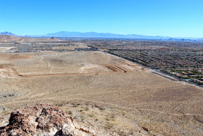 |
| View North of New Construction |
 |
| View East of Mesa Containing Geoglyph |
 |
| View of Geoglyph with Telephoto Lens |
 |
| Computer Enhanced View of Geoglyph |
Since there was a vertical cliff between the peak that we were standing on and the geoglyph, we decided to look for another trail down the mountain. Fortunately, from where we were standing it appeared that if we retraced our trail back to a saddle the we had passed through on our way up the mountain, we could work our way into a dry-wash that went down to the mesa. The wash was steep and filled with broken rock, but it appeared to be passable.
When we were part way down the dry-wash we found a circular marker on some reddish colored soil, which was unusual because the the mountain is composed of grayish-tan rock. The soil must have been exposed to some extreme heat to turn from grayish-tan to a reddish color.
We decided to climb the reddish colored mound of dirt and this is where it starts to get really spooky. At the top of the dirt mound was an excavated slot in the rock. Due to the steepness of the incline we had a difficult time climbing to the top; so there is no way that any mechanical equipment was brought to the site to make the excavation. I suspect that the slot was cut with some type of laser beam. But this is the spooky part - when you are in the slot you can see the moon during daylight hours. And, the slot points directly toward the Sagittarius Star Cluster. Located directly above the slot are two holes in the mountain. I know that this sounds a little far fetched, but the two holes could be storage ports for space ships. We did not climb up the mountain to check-out the two holes.
When we arrived at the base of the mesa that contained the geoglyph, the vertical cliffs reminded me of Devil's Tower in Wyoming. However, it appeared that if we were careful and picked the right cracks in the rock, we could free climb to the top of the mesa without using technical climbing equipment.
Now this is another exciting thing that we discovered. At the base of the mesa, we found a map carved into a solid rock that had fallen off of the cliff. Even though the rock was oriented 180 degrees from the direction is was originally pointing, I immediately recognized that the map featured the Colorado River, Las Vegas Area, and Red Rock Canyon NCA.
Once on top of the mesa we were able to inspect the geoglyph in greater detail. The Professor took some notes and made detailed sketches of the rock patterns so that he could study the pattern in more detail when he returned to the college.
Before we left the site, we had two additional surprises - first we found some strange writings on a rock that was located at the apex of the geoglyph. After studying the writings, I concluded that the writings, when translated to English, said "We Came In Peace."
The second surprise was a stone map of what appeared to be the Hawaiian Island chain before continental drift rearranged the island positions. At first I thought the map was just reddish colored stones laid on a gray rock, but upon closer examination I discovered that the reddish stones were part of the grayish colored rock! Apparently, the entire rock was first covered with a reddish colored material and then all of the reddish material was etched away except the Hawaiian Island pattern. This is really a strange area! I may have to return to determine what other unusual things are located at the site.













No comments:
Post a Comment