After leaving Titus Canyon we drove three miles on a washboarded dirt trail to reach Scotty's Castle Road, which is paved.
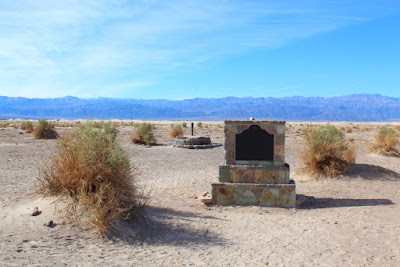
Our first stop was Historic Stovepipe Wells. A historic marker that was located at the site stated:
This waterhole, only one in the sand dunes area of Death Valley [that is potable], was at the junction of two Indian trails. During the bonanza days of Rhyolite [now a ghost town] and Skidoo [now a ghost town] it was the only known water source on the Cross-Valley Road. When sand obscured the spot, a length of stovepipe was inserted as a marker, hence its unique name [Stovepipe Wells].
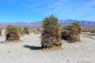
Located just to the south of the historic well is Devils Cornfield, a collection of Arrowweed plants (Pluchea sericea) that early explorers thought looked like corn shocks left to dry until harvest time. The Arrowweed plant has several straight, stiff shafts that were used by the Indians to make arrows and spears; thus, the plant's name "Arrowweed."
The root systems of the Arrowweed plants bind the soil around each plant tightly so that strong winds cannot blow away the soil that holds the plant in place. Consequently, each plant sits atop a mound of soil, while the wind has blown away the soil between the plants.
Adjacent to Devils Cornfield are the Mesquite Flat Sand Dunes, some of the largest dunes in the Park. Because of their close proximity to a paved road, these dunes are popular with hikers and sand boarders.
The dunes are formed by sand-laden winds that blow through the Valley. As the winds blow up and over the mountains, the heavier sands are trapped by the mountain barriers and deposited as dunes on the Valley floor. Since Death Valley is surrounded by mountains, sand is continually being formed as water washes stones and small grains of sand down the mountains and deposits sand at the base of the mountains. The wind then picks up the sand and carries it to the dunes. Therefore, the dunes continue to grow a little bit each year. We did not get to hike to the top of any of the dunes, but will save that hike for another trip.
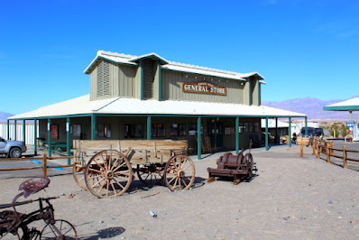
Stovepipe Wells Village is located just west of Mesquite Flat Sand Dunes and contains a general store, gas station, and a few additional buildings, including a small motel. I will not comment about the motel, except to say that it is advertised as a "unique hotel" that is "authentically western, rustic yet comfortable."
There is a Historic Marker in the Village that states:
Near this monument, JayHawker group of Death Valley Forty-Niners, gold seekers from Middle West, who entered Death Valley in 1849 seeking short route to Mines of Central California, burned their wagons, dried the meat of some oxen and, with surviving animals, struggled westward on foot.
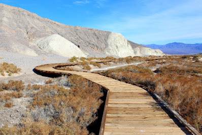
Many people are surprised to learn that there is a stream that flows through part of Death Valley. The water in Salt Creek is too salty for human consumption, but the Salt Creek Pupfish (Cyprinodon salinus) has survived in the water for thousands of years. Due to marshy soil conditions in the area, the Park Service has installed boardwalks that circle some of the scenic portions of the creek.
BONUS HUMOR


No comments:
Post a Comment