Just when I thought it was safe to go out hiking, I saw a rock that was covered with what appeared to be COVID-19 viruses - at least that is what the viruses look like when they show pictures of them on television.
Since there are more COVID-19 viruses in the Las Vegas Metropolitan Area than out in the desert, we decided to drive out to Cottonwood Canyon and hike around the Two Springs Loop Trail (Lone Grapevine Spring and Wooden Fence Spring).
This area is popular with the off-road biking crowd, so some of the hiking/biking trails are well used while other trails are overgrown with vegetation and hard to locate. And, in some places you cannot even find the trail -- you just have to navigate cross-country toward your desired destination. I was thankful that I put some waypoints in my GPS unit before we left home.
The official trailhead to start the hike is located just off of State Highway 160, but with a four-wheel drive vehicle it is possible to drive the first two miles from the highway to an alternate trailhead. However, this is an unmaintained road that you definitely do not want to try in a passenger car. (The road is in much worse condition than indicated by the pictures.)
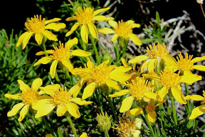
From the alternate trailhead it is difficult to find and follow the hiking trail until it connects to one of the major bike-trails a short distance away. The vegetation at the alternate trailhead is mostly small desert plant, but as the trail gets closer to the mountains there are more cactus and wild flowers along the trail.
Just before we reached the first spring, we came upon an old water tank and a pipe coming out of the hill. Either the the pipe was broken or the spring was going dry because there was no water running out of the pipe and the tank was empty.
A short distance up the hill from the water tank we located the spring and found that it had been enclosed by a wooden fence. I'm not sure why the spring was fenced, unless it was to keep the wild burrows from contaminating the water. Within the fenced area there was another old water tank, but it was also empty.
 |
| Picture by Kolohe |
After leaving the first spring we could only find the trail to the second spring part of the time. This obviously is not a popular trail with the bicyclists. We could see a green area in the distance, so we just walked toward the area following parts of any trail that went in that direction. After some cross-country travel we eventually found the second spring.
The second spring was also enclosed by a wooden fence. The fence appeared to be quite old, so it was unknown who built it or why it was constructed around the spring.
There was more water around the second spring; thus, more plants and signs of early inhabitants. The early inhabitants must have used this area as a camping spot because we found petroglyphs on the rocks and other signs of human activity.
 |
| Early inhabitants must have thought this was Palm Springs. |
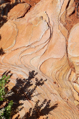
In addition to the petroglyphs, located on the rocks around the springs were petrified wood markings, various forms of lichen, and other interesting rock patterns
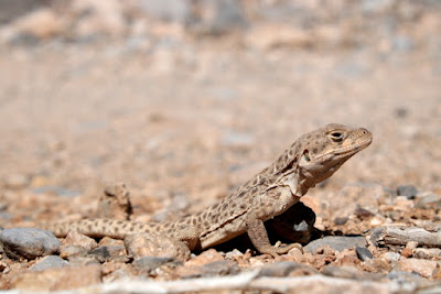
We also saw two lizards while we were hiking. I think one was a Horned Toad and the other a Western Whiptail, but Fred would probably know for certain the exact names. The Whiptail leaves strange marks in the dirt when it runs and both of the lizards blend in so well with their surroundings that we almost did not see them.
 |
| Picture by Kolohe |
 |
| Picture by Kolohe |
BONUS PICTURES BY KOLOHE


No comments:
Post a Comment