
Joseph City (population 1,386) is a small community located on Arizona's northern "Strip," about 80 miles east of Flagstaff. The community was one of four settled in 1876 by a group of pioneers from the LDS Church. Brigham City, Sunset, and Obed were the other three communities colonized, but Joseph City is the only colony that remains today. Joseph City is located on old Route 66 and has the distinction of being the oldest Mormon community located in Arizona.


When the pioneers first settled in Joseph City (originally called "Allen's Camp") they erected a fort made from Cottonwood logs and mud. The fort was occupied for several years and then demolished. On March 22, 1952, the Daughters of Utah Pioneers erected a monument on the old fort site.

The famous historic Jack Rabbit Trading Post is located about five miles west of Joseph City and is still considered to be a major Route 66 attraction. In the 2006 Cars film, the Trading Post's "HERE IT IS" rabbit was replaced with a 1923 Ford "Lizzie" as the store's owner. (Pictures courtesy of Diana Petersen)


In 1946, the "Smallest Town on Route 66" doubled in size when the owner got married. The AP even ran a national story indicating that the population growth of Meteor City in Arizona was "terrific" and increased by 100 percent when "Lonesome Jack Newsome...married Goldie Moman...last week." At that time, Meteor City boasted that they had the "World's Longest Map of Route 66" and the "World's Largest Dreamcatcher." ("A dreamcatcher is a circular frame decorated along its rim with a net or web strung across its interior. Its purpose is to help you sleep in peace by hanging it next to your bed. The web snares nightmares and lets you sleep quietly.") The map and dreamcatcher have been destroyed and the population of Meteor City is now zero!

The historic Meteor City Trading Post was a wood-frame building that burned down and was then replaced with a geodesic dome that contains a crest, which is believed to be patterned after a Navajo masked dancer (Kachina) that has a "helmet-shaped mask with feathers along its centerline marking a crest." Over the years, the dome was painted a number of different colors and decorated with a variety of Indian related paintings. When in business, the trading post sold Navajo rugs, Indian Jewelry, and petrified wood. Metero City appeared in the 1984 movie Starman, staring Jeff Bridges and in the 2006 Cars movie as Fillmore's Taste-In drink stand (located in Radiator Springs next to Sarge's Surplus Hut).


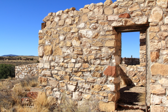
There are tepees located around the property that were used "...as a Route 66 marketing gimmick to lure in city slickers." Of course, the Navajo did not ever live in tepees -- they lived in hogans. It was the Great Plains Indians that lived in tepees.


It is unknown how long the area around Two Guns has been populated, but when pioneers entered the area they found Indian Artifacts that have now been dated to be between 1050 and 1600 AD. The first recorded history happened in 1878 when a group of Apache Indians hid in a cave at Two Guns from their Navajo enemies. The Navajos discovered the Apaches hiding in the cave and lit fires around the cave to "smoke 'em out." Some of the Apaches were killed trying to escape, but 42 Braves died of asphyxiation; thus, the site was named the "death cave."
The first pioneers settled next to the death cave and in 1922 a store, restaurant, and gasoline pumps were built by Earle Cundiff. Then, in 1925, Cundiff leased the property to Harry Miller, who called himself "Chief Crazy Thunder." To capitalize on the tourist passing the property, Miller constructed a zoo with cages made from native rock and chicken wire and then brought in mountain lions, cougars, gila monsters, coral snakes, birds and a lynx. He cleaned out the death cave and started selling Apache skulls that he found inside of the cave as souvenirs. Tours were provided (for a fee) that included the zoo, a Hopi house that Miller had constructed, and the death cave. The name "Two Guns" came form silent movie actor William S. "Two Guns," whom Miller claimed to have previously worked with in the movie business.
In 1926 Miller and Cundiff got into an argument over the terms of the property lease; so Chief Crazy Thunder Miller shot unarmed Cundiff to death. He was later acquitted of the killing. Miller left the state and Cundiff's wife remarried and opened a Texaco service station at Two Guns. The zoo was relocated to an area behind the service station. In 1963 a new service station was built and in the late 1960s a motel, western tavern, reptile exhibit, and new zoo were added to take advantage of the increasing Route 66 traffic. A Shell service station and a KOA campground were added a few years later. Then in 1971 the service station burned and people started moving to other locations. Two Guns in now a ghost town with many former structures remaining, including the trading post, campground, old cottages, zoos, and a burned out service station.


The ghost town of Canyon Diablo is located off old Route 66, about three miles north of Two Guns.
Canyon Diablo was formed when construction of the railroad was haulted in order to construct a bridge across Diablo Canyon. The nearest law enforcement was over 100 miles away, so the town soon earned the reputation as being meander than Tombstone and Dodge City combined. Main Street became known as "Hell Street" because the 14 saloons, 10 gambling houses, 4 brothers and 2 dance halls were open 24 hours a day. The first peace officer was hired at 3:00 PM and was dead by 8:00 PM the same day. Five more men were foolish enough to take the job and each one was killed in less than a month. The owner of the trading post, Hermann Wolf, was the only person in Canyon Diablo that ever die of natural causes, so they put a permanent marker on his grave. All of the others that were killed in Canyon Diablo were buried in shallow graves at various places around the property and marked with wooden crosses that were soon abandoned. There have been many stories written about Canyon Diablo that make for interesting reading.


 |
| Original Bridge - Photographer Unknown |
 |
| Current Bridge - Photographer Unknown |


Mount Humphryes, the highest peak in Arizona with an elevation of 12,633 feet, is located north of Flagstaff and is visible for many miles away.

No comments:
Post a Comment