
One night after work (several years ago) we decided to climb Mount Charleston peak. Even though it was late afternoon before we left the office, we hiked as far as possible before the sun went down and then camped for the night.
At that time the South Loop Trail was still open (now closed due to forest fire damage) and we had nice views down the valley as we gained elevation. I was in better physical condition back in those days, so we made it all of the way to the end of the meadow (tree line) before we stopped for the night.
As soon as the sun went down, the temperature dropped to near freezing and I was wishing that I had brought a tent along. In desperation, I found a hollow Bristlecone Pine trunk that had fallen over and split in half, which turned out to make a nice wind shelter.


The next morning turned out to be a beautiful, clear day; so it didn't take long before we were on the trail and above the tree line.


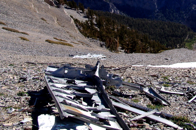
Near the saddle, we found the wreckage of a military transport aircraft that had crashed into the mountain. The plane was on a top secret mission, carrying men and equipment to Area 51 to work on the U-2 project during the Cold War. Most of the larger airplane parts have been removed from the mountain, but there is still a lot of debris scattered around the crash site.


From the aircraft wreckage, it was on to the peak!


We did not stay on the peak very long because it was very windy and cold. Using some hand-held weather instruments, we tried to measure the wind speed and estimated it to be close to 50 MPH, which is not unusual at this altitude.
Since we had used the South Loop Trail to reach the peak, we decided to return using the North Loop Trail. (The picture of Charleston Peak at the top of the blog was taken about half way down the north trail, looking southwest.)


No comments:
Post a Comment