Friday, May 26, 2017
RonnieAdventure #0257 - Turtle Head Peak, Clark County Nevada
I was driving down the Outer Loop this morning when I happened to look west and noted Turtle Head Peak in the distance. I thought to myself that maybe I should get up early tomorrow morning and hike to the top of the mountain for a RonnieAdventure!
Flashback! I let out a loud scream and let go of the steering wheel so that I could slap myself on both cheeks as hard as I could until I came to my senses. I suddenly remembered hiking Turtle Back Peak several years ago and said that I would never do that hike again.
The trail is located on the south-facing side of the mountain, so you get full sun load all the way to the top. There are no trees and very few places that you can even get in the shade to rest.
About half way up the steepest part of the incline, the trail disappears and you take two steps forward and slide back one on the loose gravel covering the hard surface. Lots of fun when the heat feels like 110 degrees Fahrenheit!
I remember when did this hike several years ago, we were on the lower part of the trail when we were passed by a young couple that had physiques like Cirque du Soleil performers. About an hour later we met them again on their way down the mountain and inquired about the time it required to get to the top. Needles to say, we were surprised when they told us that the trail was too steep and hard, so they turned around before reaching the top. Of course, that only made me more determined to reach the peak!
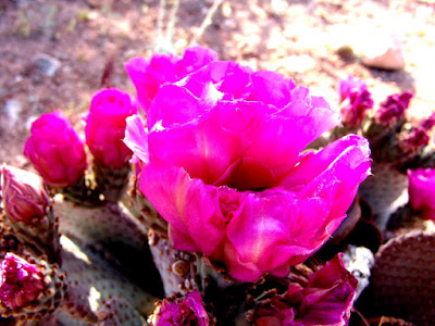
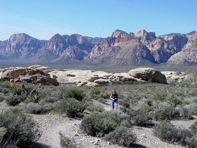
The trail started at the Sandstone Quarry in Red Rock National Conservation Area and it was a nice walk through the desert until the trail reached the Calico Tanks Junction. Because it was late spring there were lots of wildflowers along the trail to make the hike more enjoyable.
Of course, there are also a number of reptiles in the area that you need to watch out for! (One of the herpetology groups liked the rattlesnake picture so much they published it on their web site.)
After passing the Calico Tanks Junction, Turtle Head Peak appeared to be just a short distance on the other side of some sand hills; so, we assumed that this hike was going to be easier than planned.
Unfortunately, once on the other side of the sand hills, the peak was not as close as we had anticipated.
As the trail increased in elevation, the vegetation and the terrain started to change. Most trees and rocks that were higher than the surrounding objects showed evidence of numerous lightning strikes.
When we finally reached the saddle, we could see into Brownstone Canyon on the north side of Turtle Head Peak. It was interesting to view the Brownstone Canyon trails from above because I had just helped the BLM Wilderness Specialist GPS all of the trails in the area.
The top of the mountain was not a single peak, but more of a large flat area leading to a vertical drop on the south side of the mountain. Regardless, the views were spectacular!
Subscribe to:
Post Comments (Atom)


No comments:
Post a Comment