 |
| Alda, Nebraska |
Alda (Nebraska) is located about 5 miles west of Grand Island and if you blink when you pass through town on Highway US-30 you'll miss it. Surprisingly, with only a population of 647 people, Alda is the World Headquarters for Merrick Machine Company and its affiliates: the Triad Companies, Fu-Tek Machine and Tooling, and Denver Plastics.
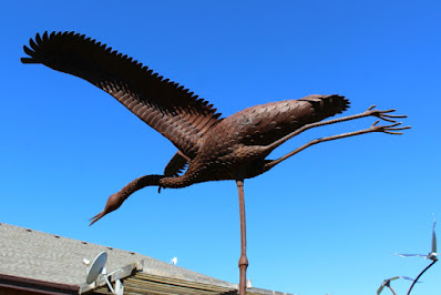
Located along the Platte River is the Crane Trust Nature & Visitor Center. During the crane's spring migration this is one of the premier Sandhill Crane viewing areas in the world. Also located at the facility are nature trails and exhibits, bison herd, art gallery and gift shop, meeting and event facilities, and crane tours during the spring months. Unfortunately, I was there in the fall when the facilities were closed. I walked around the property and did not find any live cranes or buffalo. However, I did note that the buffalo statue in front of their building had a unique design and construction.
Adjacent to the north bank of the Platte River there is a crane viewing platform and a sign that explains this "is one of the most important staging areas for the spring migration of the world's largest population of Sandhill Cranes." The sign goes on to state that "No one knows when Sandhill Carnes appeared on the Nebraska landscape. Their remains have been found in nine-million-year-old deposits in western Nebraska and in prehistoric and historic Native American sites throughout the central plains."
 |
| Crane viewing platform |
 |
| View west of Platte River |
 |
| View east of Platte River |
Continuing south to Ole Platte River Road is a historic marker that tells about the Martin brothers ordeal with Indians in 1864. Nat (age 15) and Robert (age 12) were working in a field at this location when they were attacked by a band of Sioux Warriors. The boys jumped on their horse and riding double with Robert in front, headed for home with the Indians in pursuit. Nat was hit with several arrows and one arrow passed through Nat's body and lodged in Robert's back, pinning the two boys together. When the boys fell off of their horse, the Indians could see that the boys were nearly dead; so they left without scalping them, probably because they were so young. Miraculously, both boys recovered and lived to be adults. Robert died at age 48 and Nat died at age 80. Bronze statues of the boys pined together with an arrow while riding a horse are located at various places around the area.
Following the Old Platte River Road east from the Martin Brothers marker there are two more historic markers just west of Doniphan.
One marker tells about a July 24, 1867, Indian attack on the Peter Campbell home near this location when just the mother and children were at home. Four of the children were captured by the Indians and then released unharmed about two months later. The sign said that there were two pioneer graves nearby, but I could not locate the graves.
The second marker describes the Old Platte River Road that follows the south side of the Platte River. Old Platte River Road was historically known as Old Fort Kearny Road, Nebraska City Road, and Oxbow Trail. Moving freight along the road reached its peak in 1865 when 44 million pounds of freight passed this areas. When the railroad arrived in 1866, moving freight by wagon was discontinued.
Doniphan (population 809) was established as a railroad midpoint between Grand Island and Hastings. The new line connected the St. Joseph line in Hastings to the Union Pacific mainline in Grand Island. However, in 1914 a shorter route was built that bypassed Doniphan. Trains passing through Doniphan declined and the tracks were abandoned in the late 1980s.
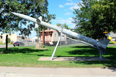
When I drove into Hastings (population 25,152), the first thing I noticed was a car show in a city park. Also located in the park were military exhibits and a steam locomotive.
Jacob Fisher's Rainbow Fountain is located just a short distance away in Utilities Park. The fountain was built to symbolize hope and harmony during one of the most difficult times in Nebraska History - the Great Depression and the Dust Bowl. This is the largest water fountain between Chicago and Denver. Unfortunately, I was not there at night to see the fountain's rainbow colors light show. I do not know the significance of the Statue of Liberty at this location.
During WW II the Federal Government built the largest munitions plant in United States just ease of Hastings. The facility occupied 40,000 acres of land, had 207 miles of railroad track, 274 miles of roads, 2200 buildings, and employed 10,000 people that worked 60 hours per week. At one point during the War, the plant produced 40% of the Navy's ordnances, including sixteen-inch shells. In September of 1944, an accidental detonation killed 9 workers, injured 53 more, and left a 550-foot long crater. The blast was felt 100 miles away. This was one of Hitler's planned top five targets if he invaded the United States.
Many of the buildings have been razed, but there are still about 8 miles of existing buildings and storage bunkers, some of which are now occupied by private enterprises.


No comments:
Post a Comment