 |
| Picture by Kolohe |
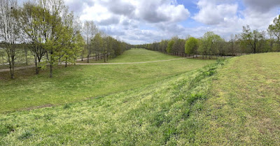
Located along the Tennessee River in Florence (population 40,184) is the largest earthen Indian mound in the Tennessee Valley. The mound is 43-feet high with a base of 230-feet by 310-feet. The mound's flat top measures 94-feet by 145-feet.
We watched an interesting movie that explained how the mounds in this area were constructed. Without the benefit of modern tools, builders used bones for scrapers and then carried the dirt in woven baskets to the mound site, which required a lot of manual labor.
Based on the best information available, archeologist estimate that the mound was build between AD 100 and 400. It is believed that the mounds were used for ceremonial temples or as the chief's housing complex.
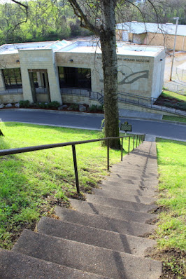
There are steps that lead to the top of the mound where various trees are found.
 |
| Picture by Kolohe |
 |
| Picture by Kolohe |
Be careful of what you say, because people may prove you wrong.
In 1872 Tom Clark terrorized the citizens of Florence, confessed to at least nineteen murders, then bragged that no one would ever run over him. The townspeople were outraged, hung Clark, and then buried him in the center of Tennessee Street. People are still running over Clark today. There is a historic marker on the side of the street that recognized the approximate location of where Clark is buried.
The house was built in 1940 for Stanley Rosenbaum, a professor at Florence State Teachers College, for a cost of $14,000. Mrs. Rosenbaum lived in the house until she was moved to a nursing home in 1999, at which time the house was donated to the City of Florence. Tours are available on a scheduled basis, but was closed when we stopped by for a visit.
 |
| Picture by Kolohe |
While Kolohe was taking a picture of the Limestone County Courthouse in Athens, we noticed a pizza parlor across the street. The smell got to us, so we had a pizza followed by ice cream at what was reported to be the oldest ice cream store in Athens. We had to stop at the ice cream store when we noticed that the building looked like a Zesto.
 |
| Picture by Kolohe |
 |
| Picture by Kolohe |
 |
| Picture by Kolohe |
In 1833, the Tuscumbia-Courtland & Decatur Railroad was the first railroad built west of the Allegheny Mountains to bypass shoals in the Tennessee River. The historic train depot museum in Decatur (population 57,938) was not open when we stopped by, but as we were taking pictures of the depot a train went by and the engineer honked his horn at us. Or, maybe, he just honked his horn as he was crossing the street.
 |
| Picture by Kolohe |
The Cook Museum of Natural Science was reported to have some amazing and unusual exhibits. Unfortunately, the museum was not open until later in the day; so we did not get to visit the facility.
Morgan County residents likes to brag that their county is older than the State of Alabama. The Territorial Legislature created the county from lands ceded by the Cherokee Indians in 1818. Alabama did not become a State until 1819. The county seat was originally in Somerville, but was moved to Decatur in 1891.
Across the street from the Lawrence County Courthouse in Moulton (population 3,398) was a fenced vacant lot that contained some interesting wall-art.
Jesse Owens was born near Oakville (an unincorporated community) in 1913 and obtained his fame in Berlin at the 1938 Olympic Games. Because he was black, Adolph Hitler refused to present Owens his four gold medals.
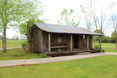
We toured the Jesse Owens museum and a sharecropper cabin located on the museum property. The cabin contained three rooms - a bedroom for the parents, a bedroom for the kids, and a kitchen.
A docent explained that the original Owens cabin was destroyed, but the cabin on display was from the same time period and from the same area where the Owens cabin was located.
 |
| Picture by Kolohe |
 |
| Picture by Kolohe |
 |
| Picture by Kolohe |
 |
| Picture by Kolohe |
Located a short distance west of the Owens Museum is the 27-foot tall Oakville Indian Mound, which is the largest woodland mound in Alabama. The base of the mound covers 1.8 acres and the mound's flat top contains about one acre.
The Cherokee Council House Museum at the site is based on a seven-sided Cherokee council house. A marker states: "The seven sides represent the matrilineal clans of the Cherokee: Wild Potato, Long Hair, Paint, Wolf, Deer, Bird, and Blue."
 |
| Picture by Kolohe |
 |
| Picture by Kolohe |
 |
| Picture by Kolohe |
 |
| Picture by Kolohe |
 |
| Picture by Kolohe |
According to a historic marker by the side of the road, Byler Road became Alabama's first state road when Governor Bibb signed into law a bill authorizing its construction on December 16, 1819. The Road connected Courtland with Tuscaloosa.
BONUS PICTURES BY KOLOHE


No comments:
Post a Comment