Fort Ross State Historic Park was our first stop. The Park features items from several cultures, including Russians, Kashaya Pomo, Cost Miwok and Southern Pomo Indians, Aleutian and Kodiak Islanders, and Creoles (the children of Russian men and Indian women).
Fort Ross was established by Russians in May of 1812 to supply food and shelter for their trappers that were hunting fur-bearing sea otters. Native Alaskans had a village outside of the Fort and were employed as hunters and a workforce to support the Fort. Although the Fort walls have been replaced several times, the original walls were 1,204-feet long on each side and 14-feet high. Historical information indicates that "The walls were held together by a complex system of mortised joints locked by wooden pins. The top truss and sills were locked into main posts, spaced about 12-feet apart and buried 6-feet below ground."
A 34-foot deep well was located inside of the Fort's parameter walls to provide a water source in case of an attack.
For protection there were four 5.5-inch cannons inside of the Fort that were mounted on field carriages so that they could be moved about easily in case of a battle. The Fort was never attacked; so the cannons were never used, except for ceremonial occasions.
The chapel was built in the mid-1820s. Outside of Alaska, it was the first Russian Orthodox structure built in North America.
A transcription of writings on the Chapel Bell state: "Heavenly King, receive all who glorify Him." According to information by the Park Service, the "Russian Orthodox cross on top of the chapel cupola has a short bar on the top representing a sign nailed to the cross 'Jesus of Nazareth - King of the Jews.' The middle bar represents Christ's crucifixion, the angled bottom bar points both toward heaven and downward, signifying the disposition of the two thieves flanking Christ when he was nailed on the cross."
The original barracks were built before 1817 and were also used as a workshop. An 1817 map of the Fort survived and it references the barracks as "house of planks containing a foundry and workroom for a coppersmith."
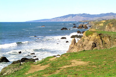
It is only about 700 feet from the Fort to the Ocean and there is a nice trail that can be followed down to the beach.
Mendocino Headlands State Park is north of the Fort near the town of Mendocino. As part of the Park, a nice arch spans part of the bay entrance.
Located to the north is Van Damme State park, which contains a pygmy forest. Poor soil conditions in the area created a marshy ecosystem that has stunted the growth of cypress and pine trees and rhododendrons. So that visitors can have a closeup view of the plant materials, a nature trail with an elevated boardwalk winds through the forest.
Ocean waters just offshore from the State Park form the Van Damme State Marine Conservation Area, which is popular with kayakers that tour the shoreline and sea caves.
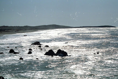
We stayed in Fort Bragg overnight and in the morning there were beautiful views of the ocean.
The World Famous Skunk Train (aka California Western Railroad) is a scenic tourist train that leaves Fort Bragg and meanders up Noyo River Canyon for 3-or-4 miles and then turns around and returns on the same route. This is not a fast-moving train, so there is ample time to enjoy the scenery.
Continuing our journey northward, we stopped for pictures and a short hike in MacKerricher State Park.
The famous Chandler Drive-Thru Redwood Tree is locate at the Junction of Highways 1 and 101 and a "must see" tourist attractions. After driving through the tree, we followed Highway 101 back home, which was a lot faster than traveling north on Highway 1.
BONUS PICTURES
Shortly after our trip up Highway 1, Greg was in San Francisco on a business trip; so on the weekend we drove over to Marin County and Muir Woods National Monument.
Once back in San Francisco we stopped by the Cliff House and Sutro Baths ruins, which are adjacent to each other. At that time, the Musee Mecanique was located in the basement of the Cliff House and Camera Obscura was located on the outside patio.
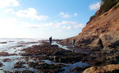
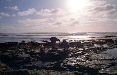
It happened to be low tide that afternoon, so we stopped by some tide pools on our way back to our home in Concord.


No comments:
Post a Comment