On October 20, 1850 Mormon pioneers first settled in what is now known as Payson (Utah) and by 1851 there were sixteen families living in the area. They built a small fort around their settlement and called the town "Peteetneet," after the local Ute Indian leader. Brigham Young later changed the name of the town to "Payson," in honor of James Paces, the settlement's founder.
Logs for the first fort were cut from the nearby creek and lashed together so tightly that even a small animal could not penetrate the walls. According to the Payson Historical Society: "In 1853 Indian uprisings made it necessary to enlarge the fort to accommodate the families that had moved into the new settlement. The fort had a four-foot deep moat at the bottom, a base of rocks and an eight-foot wall of adobe with bastions on the corners. It was about four city blocks square. The main gate was on the east side."
The Payson Historical Society gave me a small booklet that contained a walking tour of the original town site and a map that showed the locations of various historical markers. The booklet also contained a description of each marker and what happened at the site.
I decided to follow the historic walking tour, which started at the fort's southeast corner. There are two foundations at the corner because on May 20, 1973, the original marker was washed away when an upstream reservoir broke and sent a nine-foot wall of water down the canyon and into the town of Payson. The original marker was later recovered, so now there are two foundations in slightly different locations.
A plaque at the corner marker states "The fort was 60 rods square with corners built of logs forming a buttress.. Adobe, rocks, and mud walls stood 8 feet tall, 4' wide at the bottom and 2' at the top. On a rock foundation with a deep 4' trench around the outside. It was built during the Walker Indian War 1853-1854." The Main Gate marker is just a few yards north of the fort's southeast corner and the plaque states: "Just inside was a stagecoach inn and Pony Express Station which operated until the telegraph came in 1861." Almost the entire historic area is now covered with modern houses.
 |
| Southeast Corner of fort and location of main gate |
 |
| Northeast Corner of fort |
 |
| Northwest Corner of fort |
 |
| Southwest Corner of fort |
 |
| Cow Lane - Path used to move cattle to pastures |
A statue of Peteetneer, the Ute Indian Leader, stands in front of the west side of the building, but most people enter the building from the east side, which is also very picturesque. Entrance to the museum is from a new addition located to the north of the school building.
 |
| East entrance to building |
An early log cabins that was built in 1863 by Everett Richmond has been preserved and relocated to the Payson City Center.
The population of Payson in the 2010 Census is listed as 18,294.
The current Payson City Library was build in 1925 as a JC Penny Store and then converted to a garage, an antique store, and in 2000 purchased by the City for a municipal library.
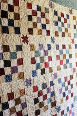
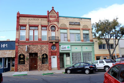
The downtown historical area is filled with small shops, including a quilt shop.
Payson City's Memorial Park contains numerous historical monuments, in addition to some nice picnic facilities,
A pioneer millstone in the Park marks the approximate location of the first public building -- a log cabin that served as a church and school.
In 1853 a saw mill and flour mill were constructed in the area and in 1860 one of the first nail factories west of the Mississippi River was built. A plaining mill, one of the first in Utah Territory, was constructed in 1861 and Payson's first public school was opened in 1866.
A plaque near the original school bell states that the first two-story brick building in Payson was located 377 feet west and 14 feet south of this marker. The building was used for City offices, the first high school, and a recreation center. The City Marshal rang the bell in the morning signaling the start of school and then again at 8 PM signaling a curfew for children under 12 years of age.
There is also a memorial that was built in memory of Alexander Keele who was killed on July 18, 1853, while on guard duty during the Walker War.
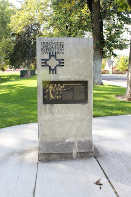
Also located in the park is a marker commemorating the the Dominguez y Escalante Expedition of 1776.
On July 29, 1776 Fathers Francisco Atanasio Dominquez and Silvestre Velez de Escalante left Santa Fe to discover a northern overland route to Monterrey, California. In early September the party passed through Spanish Fork Canyon and entered the Utah Valley, where they stopped to preach Christianity to the Indians that inhabited the area. However, by October the party was discouraged by the cold weather and, running short of supplies, they decided to return to Santa Fe. After a 2,000 mile journey, the expedition arrived back at Santa Fe on January 2, 1777.
There were many beautiful trees with fall colors along the roads around Payson.
BONUS PICTURE (horse with his dress hat on)


No comments:
Post a Comment